Hiking L.A.

Blogged: August 24, 2006

Panorama Trail - Yosemite

Hiked: August 19, 2006


My entry for this hike requires a few disclaimers. First: I know Yosemite isn't exactly in Los Angeles. I also know that this is supposed to be a blog about hiking L.A., but you're going to have to cut me some slack. In truth, Yosemite isn't all that far from Los Angeles. If people travel from all over the world to see Half Dome and El Capitan, Angelinos certainly can jump in there car and check it out. (According to Google Maps, it's 311 miles from Los Angeles to Yosemite.)

More information: I grew up in scenic Fresno, the raisin capital of the world that's currently run by Capt. Bubba Skinner. Dad still resides in the 'no, and he likes to take advantage of its close proximity to Yosemite. He had hiked the Panorama Trail once before and had been recommending it to BF and I for quite some time. After a lot of scheduling mishaps, we finally decided on a mutually-agreeable weekend to hike the trail. Our plan was to come up to Fresno on a Friday night, sleep a few hours, then head up to Yosemite Saturday morning. After the hike, we'd return to Fresno, sleep, and then head back to L.A. on Sunday. That way we wouldn't have to miss work.

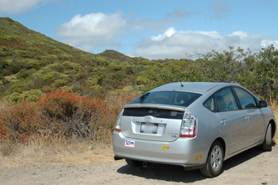
Here's who joined BF and I on this hike: dad, mom, Panda and Xmas. You may remember my dad as the guy who took pictures of his Toyota Prius on the Mishe Mokwa Trail. Even though my parents have been divorced for ten years, dad invited mom to come on the hike, too. They're friends now. It's all very progressive and mature of them, don't you think? It seems like the premise for a sitcom on the ABC Family channel.

Panda and Xmas are two of my friends that I met in grad school. I could call them by their initials, like I did with EVG, but calling them by these names is much more amusing to me. Regardless, Panda and Xmas are best friends and roommates, they're both from Connecticut, and they're both fiction writers. I originally only invited Xmas to join us on the hike, not because I don't like Panda, but because she was out of town when we originally planned the hike. Luckily for Panda, dad and I had scheduling conflicts that pushed our hike back to a day when she could join us.

Once Xmas got home from her fancy showbiz job, and after we took care of a little foster cat drama we got on the road to Fresno. We arrived at my dad's house around one a.m., just in time for three hours of sleep.

In the morning, Panda and BF complained that they both didn't really get any sleep. Xmas and I had slept some, but three hours isn't exactly enough to make you feel bright-eyed and chipper. Nonetheless, we all somehow managed to get dressed and on the road by 5:30.

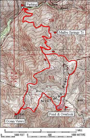
The Panorama Trail is a one-way hike. To get started, you park in Yosemite Valley and take a bus from Yosemite Lodge up to Glacier Point. The bus ride took about an hour. Our driver was a well-intentioned but nonetheless annoying woman who insisted on talking about mountain elves and referring to all pines as "Christmas trees". Luckily, the seats were comfortable and we all nodded off for most of the drive.

Once at Glacier Point, you are suddenly accosted by the magnificent view of Yosemite Valley below you. Here's what I'm talking about:

Yosemite Valley

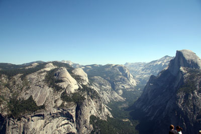
It's certainly an awe-inspiring place. The six of us walked around Glacier Point taking pictures for about a half hour before we realized that we'd have great views all along the trail. It was getting on to noon, and we really needed to get on the trail.

As you may have noticed, BF has a very nice digital SLR camera. My dad also has a similarly nice digital SLR from a different manufacturer. BF even has a fancy telephoto lens with a gyroscopic stabilization system that allows him to take very detailed pictures of far away things. Case in point: the hikers on top of Half Dome:

People on Half Dome

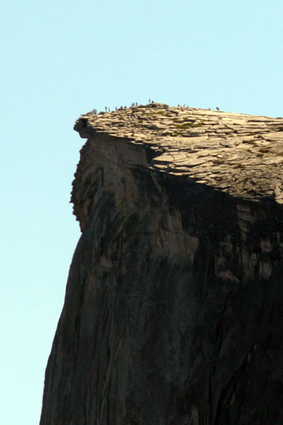
Those little specks of people were barely visible through binoculars from Glacier Point.

As opposed to dad and BF, with their multi-megapixel contraptions, Xmas had brought along two disposable cameras. Now, I'm the first person to celebrate the merits of disposable cameras. The investment is small so you never have to worry about breaking them. The only problem is that once you've taken 36 pictures you're done.

This becomes a distinct problem on the Panorama Trail because every step you take brings you to a new, amazing vista. I believe Xmas finished her first two cameras in the first mile of the hike.

The Panorama trail takes a wide loop from Glacier Point and curves around past Illouette Falls, then behind Half Dome past Nevada Falls, and finally Vernal Falls. Dad had told us that the trail was "mostly downhill, with a little uphill part in the middle." Seeing as we started at Glacier Point, 7274 feet above sea level, and we'd be ending at Yosemite valley, 4000 feet above sea level, I believed him. How much uphill could there possibly be? The trail was only 8.2 miles long, after all.

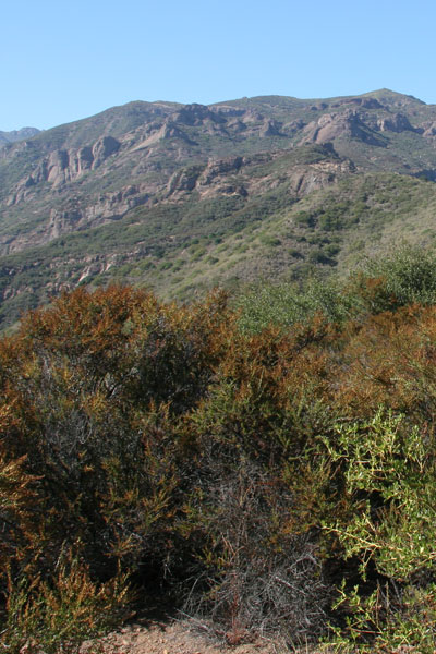
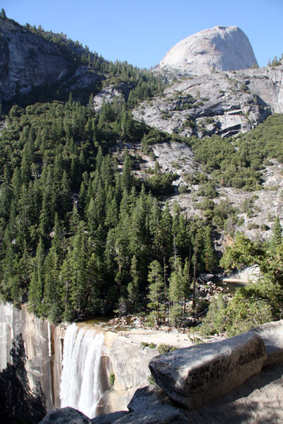
As we got started on the trail, dad gave mom one of his hiking sticks—essentially a collapsible ski pole—to help her with the hike. This would become a very important tool for mom as the hike wore on. But first, the initial views:

Two Waterfalls

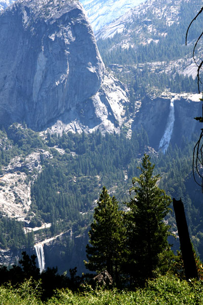
The upper waterfall is Nevada Falls, and the lower one is Vernal Falls. This was mid-August, so the falls were supposedly on the weaker side. You could have fooled me and Xmas—we both thought they were pretty big.

The beginning of the hike takes you gradually downhill towards Illouette Falls. We stopped often to take pictures and enjoy the views, but we were making good time. Here's a picture of Illouette Falls as we approached it:

Waterfall and Half Dome

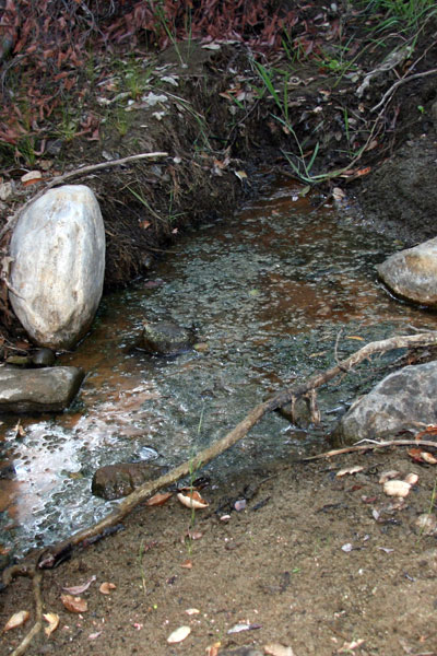
We arrived at the crystal-clear pool above Illouette Falls around noon, and we decided to sit down and eat lunch. The water looked inviting, so Xmas took off her shoes and waded in ankle-deep. Dad decided this would be the perfect time to test out his new UV Water Purifier. (I had stumbled upon this device reading over other hiking blogs, and when I showed it to dad he immediately wanted one.) Dad took a sample from the river and, after sterilization, I had a sample. The water was refreshing and tasted quite good, and to this date (over a week later) we haven't gotten sick.

One of the reasons I had encouraged dad to take water from the river was because I was concerned we didn't have enough bottled water to go around. BF and I packed our usual large amount of partially-frozen water, more than enough for the two of us. Dad had plenty, too. Xmas and Panda reassured all of us that they had enough, so we didn't press them for details.

Mom, on the other hand, clearly didn't have enough water. When I asked her if she had water, she pulled a small bottle of diet pepsi and a bottle of club soda out of her fanny pack. I told her this wasn't enough, but she didn't seem to agree with me. It turns out that dad hadn't quite explained to mom just how strenuous the hike was going to be. In fact, he hadn't quite been accurate in his description of the trail to any of us.

After leaving Illouette Falls, the trail began to climb uphill. Jokingly, we immediately started razzing dad about his claim that the hike was "mostly downhill." Our tone became less humored and more accusatory as the trail kept climbing. Mom and I climbed the trail slowly, the rest of the crew having hiked ahead of us at the beginning. Every couple hundred feet, mom would stop and say, "it keeps going up!" I was trying to use positive thinking to my advantage, and my mantra was "it couldn't possibly go much higher." Mom was the pessimist, I was the optimist. In the end, mom was right. It did keep going up.

I can understand why mom was exasperated. Three months prior, she had fallen sick and ended up in the E.R. with a raging case of sepsis. According to my stepdad, there was a point during the night she was admitted when she was very close to death. My mom is a doctor (as are my dad and stepdad) and the infection that knocked her out was a particularly gnarly hospital infection. These are bugs that generally only hang out in hospitals, where they mutate into antibiotic-resistant monsters that are difficult to kill.

Luckily, mom survived her ordeal and had been on the steady road to recovery all summer. But all was not back to normal. Most notably, her hemoglobin levels were still low. Hemoglobin is what transports oxygen from your lungs to the rest of your body. Hiking uphill at 7000 feet, you better have your hemoglobin working full-force. Unfortunately for mom, this wasn't the case.

And so, we took the uphill part slowly. It turns out that dad's "little uphill part" was a little more substantial than reported. According to yosemitefun.com, the Panorama Trail actually has 1964.8 feet of elevation gain.

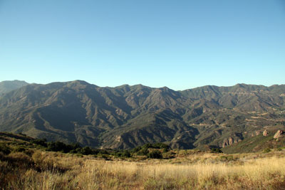
Mom is a trooper, though, and we eventually made it to the top of the climb. We got some great views of the back-side of Half Dome during the climb:

Half Dome from Behind

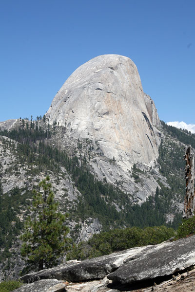
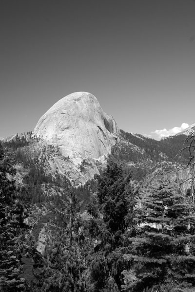
BF switched his camera to black-and-white mode in what seems to be a tribute to Ansel Adams:

Half Dome in Black and White

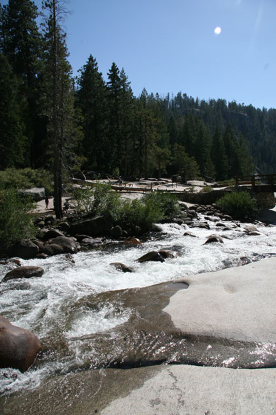
And so we started back downhill towards Nevada Falls. Up to Nevada Falls, we had only seen a dozen or so other hikers on the trail. Even though it was the height of tourist season and a Saturday, the trail was pleasantly unpopulated (unlike the valley and Glacier Point). But, when we got to Nevada Falls, we were suddenly confronted with hordes of other humans! Well, I may be exaggerating a bit, but there were definitely more people to be found. We soon figured out that this is because you can access both Nevada Falls and Vernal Falls by relatively short hikes from the valley floor.

Regardless, we took a much-needed rest at the top of Nevada falls:

Above Nevada Falls

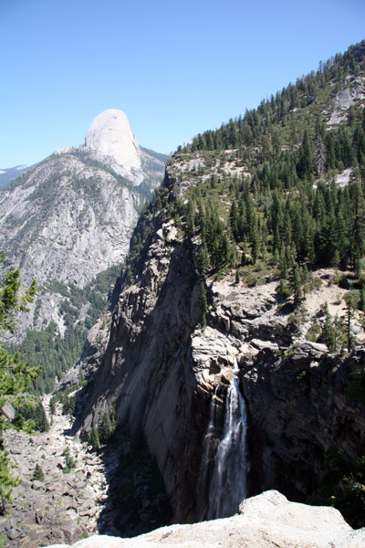
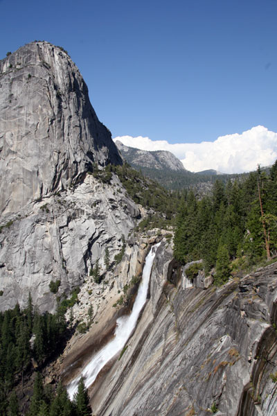
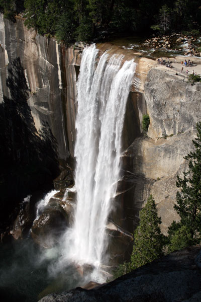
We then doubled back and hiked alongside Nevada Falls towards Vernal Falls and got this great view:

Nevada Falls

And then as the trail approached Vernal Falls:

Half Dome and Vernal Falls

Vernal Falls

The trail leading up to Vernal Falls was beginning to get quite steep, and we were all feeling it in our knees and ankles. It was getting late, so we didn't dawdle at Vernal Falls. Instead, we decided to head down. There was only about a mile left of the hike, so we were getting excited about the prospect of a big dinner and a soak in mom's hot tub.

Little did we know that the Mist Trail steps were ahead of us. Below Vernal Falls, the trail consists of countless stone steps that wind steeply down the side of the waterfall. In 0.3 miles you lose about 1000 feet of elevation. After hiking from Glacier Point, this descent is killer on your joints. Mom, dad, and I all had to take our sweet time hobbling down the stairs. Mom had to stop at one point and lie down because she was so exhausted. My legs were trembling as though I were shivering, and my knees were aching with each footfall.

In the midst of all this, the sun hit the mist off Vernal Falls and BF took this amazing photo:

Rainbow below Vernal Falls

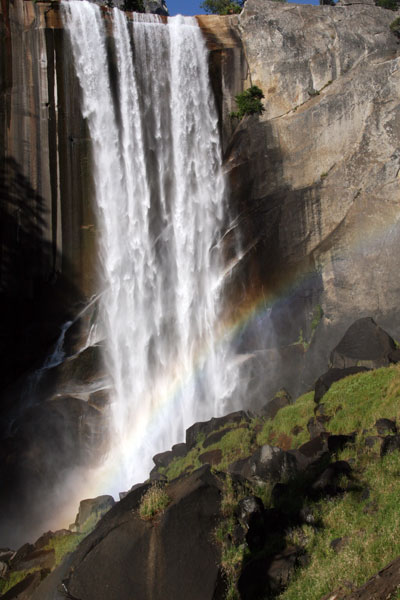
And, no, that is not photoshopped in any way. Well, I resized it in Adobe Photoshop, but that's it! Isn't it a great shot?

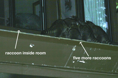
So, we somehow made it down to the valley floor in more or less one piece. We took the shuttle bus back to the Yosemite Lodge where our cars were parked. The sun was just going down as we arrived at the lodge, and apparently that meant it was time for the raccoons to come out in full force.

There were a few raccoons wandering around the grounds of the lodge, completely unfazed by all us humans. But what was more disturbing was the horde of raccoons on the roof of the lodge. I first noticed about six of the masked furballs wandering in a pack on the roof, and someone said, "they're coming out of a room!" Well, that made me pay more attention, and we watched as the group went to the next window, quickly pulled off the screen, and went looting. Here are some grainy action shots:

Mischevious Raccoons

Raccoons Breaking Into Lodge

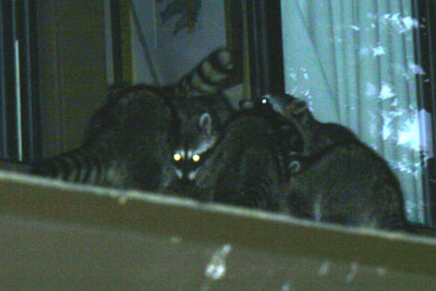
I decided that the responsible thing to do would be to go tell the front desk. As I approached, I noticed there was a raccoon standing guard outside the front door. Apparently he was their lookout. Eventually, he wandered away, and I told the manager that raccoons were systematically breaking-and-entering into guest rooms. He sighed, picked up the phone, and unenthusiastically told me, "this has happened before."

After admiring the raccoons' ingenuity for a few more minutes, we all decided it was time to get on the road. We stopped in Oakhurst for dinner, having found a lovely Italian restaurant that was still open and would take six sweaty, grimy, tired hikers. Unfortunately, I had started to feel quite ill on the drive home. I had eaten plenty of food and imbibed plenty of water during the hike, but somehow my internal equilibrium was not right. At dinner, I was hungry but incredibly nauseous and unable to eat any of my delicious-looking chicken piccata. I did manage to eat a few bites of salt-laden baked potato. My mom had suggested I try that because she suspected I was low on salt. I now think I had a mild case of hyponatremia. Whatever it was, I felt awful and I was embarrassed that I was such a miserable dinner companion.

I also inadvertently insulted my mom by suggesting that I drive home with dad instead of her. I only suggested it because I know dad drives slower than my mom, and I was hoping this would curb my nausea. Unfortunately, I think mom took this as a judgment about her driving. In all honesty, I was feeling so awful that I wasn't really able to make such a judgment. I just wanted to get home without ralphing.

I succeeded, and actually felt much better once I got home. The salt I poured on that baked potato must have kicked in.

The next morning, Xmas, Panda, BF and I all slept in late, working off the exhaustion and sleep-deprivation we had accumulated since Friday. After waking up and enjoying some coffee, we all went over to mom's house for a huge brunch of cheese, smoked salmon, hummus, scones, fruit... you name it, she had it. Then we all retreated to the back yard and took advantage of mom's fabulous pool and hot tub before heading back to Los Angeles.


Blogged: August 16, 2006

Devil Canyon

Hiked: August 12, 2006


I'm not sure why, but I'm really feeling a strong aversion to writing this blog post. Maybe its because all the events surrounding the hike were relatively infuriating, or perhaps it's because the hike itself wasn't particularly eventful. Regardless, I shall push on and write. Here goes nothing.

BF and I weren't sure if we'd get to hike this weekend. On Friday, we were supposed to be contestants on a new game show—the name of which shall not be mentioned because the network can sue me for a million dollars for just about anything at this point. The release form was pretty hefty, and I'd rather not violate its terms. Hell, even talking about the release form probably violates its terms. I better stop while I'm ahead. Regardless, Friday morning was our call time, but they told us to keep the whole weekend clear. Well, after about 10 hours of sitting around on Friday, we never became contestants on said game show. They told us to come back Sunday afternoon, so we had all day Saturday to hike.

I also was able to go to flute choir, which was a nice bonus. Of course, by the time I had come back from the music center, eaten lunch, and sat around watching TV for a while, BF and I still hadn't chosen a hike. We wanted to do a relatively easy hike, and because it was a very hazy day, I vetoed anything that had a "good view." Nothing could have had a good view on Saturday. Finally, we decided on Devil Canyon (not to be confused with Devil's Canyon) in Chatsworth. It was supposed to be a 5-mile hike with only 500 feet of elevation gain—exactly what I wanted. I used Google maps to find our trailhead's longitude and latitude, printed out the directions and the trail map, and we jumped in the car.

It was already 4p.m. by the time we left the apartment, but the freeways were clear and we arrived at our destination by 4:30. Unfortunately, our destination did not seem to exist. We consulted the map, and we were certainly in the right place. But where was the trailhead? All we saw were some massive ravens picking at roadside garbage. BF and I drove around for about a half hour looking for the trail. We went up a nearby side street only to find ourselves in the middle of a huge construction zone. We drove around some private streets and found nothing. Finally, we returned to where we started and explored a little on foot.

There was nothing to be found. Finally, a local resident called out to us from his passing car. He informed us that you can't get to the trail anymore because of the aforementioned construction. In order to find the trail, we'd have to get creative.

We drove around the corner to a large apartment complex where the guy had told us we could find the trail. BF got out of the car and hiked around for a while without finding anything. Finally, I consulted my handy Thomas Guide and saw that there was supposed to be a creek off to our North. We drove deep into the apartment complex and found a parking spot that seemed unreserved. Ducking under a wire fence, we saw our trail down the hill below. We quickly suited up, me wearing the camera bag and BF carrying the heavy backpack, and boogied out of the parking lot before a resident reported us for trespassing.

We descended along a small hill on the back side of the construction. Here's why you can't find the trailhead anymore:

construction

With all those sprinklers and backhoes in the way, there's no real way to get to the trail without committing a minor misdemeanor. Of course, after all these delays, it was almost five o'clock by the time we started hiking.

Heading down the trail, you pass a rusted-out, wrecked car on your left:

car_cass

This was my first indication that we were in the right place, because I remember it being mentioned in the Los Angeles times article about this trail. We pushed on and found a fork in the road where a dirt trail went off to the right and a gravel path continued straight. Here's a bit of advice: take the gravel path. BF and I took the dirt path about 300 feet up a hill before realizing we weren't in the right place.

Back on the right trail, we found our way along the mostly dry creek with ease. The main features of this hike are all the interesting sandstone formations along the canyon walls. For your consideration:

sandstone

rock_wall

rock_formation

The trail follows a seasonal creek, which was pretty dry in this season. There were a few puddles of stagnant water to be found that were less-than appetizing:

water_gross

The only real obstacle on our hike was a lovely tree that had fallen right across the trail. However, it was an easily-overcome foe:

fallen_tree

Supposedly, you're only supposed to hike to a locked gate, but when BF and I found the gate, it was wide open. We decided we hadn't gone far enough, and we just kept going. We found these cool flowers and BF got artistic with the ye old camera:

flower_top

flower_closed

Just past the gate is an old concrete dam:

dam

We kept hiking until we realized that it was getting dark and it was time to go home. Turning back around, it got dark very quickly. But compared to our crazy night-hiking experience the week before, this was like walking down a multi-lane highway. We both had flashlights, and we just cruised along, enjoying the sounds of owls, frogs, and crickets. Speaking of frogs:

bigfrog

Also, the flowers we enjoyed earlier must have been night-bloomers, 'cause they were opening up:

flower_open

We got back to our car, which, thankfully, hadn't been towed and headed on our way home. See? Nothing dramatic happened on this hike. It was just pleasant, like most hikes should be! And we only lost our way once. What's happening to BF and I? It's almost like we're becoming responsible outdoorspeople or something.

Check back next week for my report on the Panorama Trail in Yosemite National Park. I know it's not near L.A., but it'll be a great hike!


Blogged: August 8, 2006

Malibu Spring

Hiked: August 5, 2006


What is it those pesky Boy Scouts always say? "Be prepared"? It's a good idea in theory, but in real life you can never be fully prepared. Sure, you can try to prepare for all foreseeable scenarios. But when hiking, this makes for a very heavy backpack. What "be prepared" really means is: have some useful supplies, and be resourceful when those supplies aren't enough.

By this standard, BF and I were "prepared" for our hike on the Malibu Spring Trail. (I am here to tell the tale, after all.) By all other standards, though, we were woefully under-prepared for our adventure. There were a few key things we lacked.

Things We Lacked:


1) An early start. As usual, BF and I had mitigating circumstances that prevented us from getting out to the trail early. The official explanation for our late start was this guy:

peter_web

His name is Peter, and he was one of our foster cats. BF and I have been taking in foster cats for the Southern California Siamese Rescue (SoCSR) for a few months now. Peter had been adopted by a woman in Phoenix, and someone from SoCSR came by to pick him up to take him to his new home.

Of course, I call this the "official" reason because Peter was in his carrier and on the road by 9:30 a.m. The real reason BF and I got a late start was because we decided to go back to sleep after Peter left.

2) A proper map. We had very sketchy directions to the trailhead. We would have missed it, but a nice resident of Malibu, noticing our navigational distress, pulled over to show us to the right place. When he asked where we were going, I told him "Nicholas Pond, via the Malibu Creek Trail."

"Oh, you're way off!" He proclaimed. I didn't believe him. I knew we hadn't found the trailhead, but I also knew we were on the right road. Nice Resident disagreed. But when I showed him the Google map of the site, he relented and said we had just passed it. But he did question our judgment.

"That's the long way to get there. It's like 3 miles straight up that hill. You don't really want to do that, do you?" He protested. We assured him that yes, we did want to hike up that hill, and though he raised his eyebrows, he didn't stop us. He did warn us that there were "a lot of ticks" on that trail, and we definitely needed long sleeves for the hike.

3) Long-sleeved shirts. Though I had read some of the trail reviews on LocalHikes, I didn't think the conditions would be bad enough to merit a long-sleeved top. In a rare moment of foresight, I did somehow manage to put on long pants and remind BF to do the same. When we arrived at the trailhead, BF and I saw why covered limbs would be preferable. The trail was beyond overgrown. A chain-link fence marked the beginning of the "Malibu Creek Trail." There was some remnant of trail at our feet, but everything ahead of us was dense foliage, with the occasional cleavage indicating where the path would lead. It looked just like this:

brush

If BF and I hadn't been wearing long pants, we would have turned around immediately. But since most of the brush had only metastasized to armpit-level, we decided to give it a go. It was 4 p.m., after all, and if we wanted to finish this hike before dark, we'd have to get on our way.

Because of all the stories of the hike being "ticky", BF and I ended up developing our own obsessive-compulsive tics along the way. Whenever we had an intimate encounter with a bush or a tree, we would systematically wipe our hands over all exposed skin areas. Because the flora on the non-trail was so ubiquitous, we had to do this more or less continually during the first two miles. We probably looked like escaped mental patients---luckily there was no one to witness our perpetual gesturing. I probably got an upper-body workout, too. There's always a silver lining. Always.

4) A navigable trail. Calling this a "trail" is generous. Because of all the unruly plant life, finding the right path was mostly guesswork. BF and I were wandering more or less blind for the majority of the afternoon. After about two miles, we found ourselves at a nice overlook of the Santa Monica mountains:

landscape

There were also these monstrously large satellite dishes watching us:

satellite

We had printed out the topographic map of the trail from LocalHikes:

topo

According to this map, we were supposed to come to a junction where we'd take a right, head out to a nice "ocean view", then continue on to the pond.

BF and I hadn't realized we were off the trail until we arrived at a golden meadow, with no discernible path in sight. BF decided just to head up the hill, his logic being that we were supposed to be going up, so "up" is where we'd go, trail or no trail. I followed him at first, then I got cold feet and insisted we return to the meadow to look for a real trail. When we didn't find one, I defaulted to BF's logic and followed him up the hill. Lo and behold, we found what appeared to be a real hiking trail at the top of the hill. I thought we were home free. We took a right and eventually came to an actual trail marker. This must mean we're in the right place, I thought. I was wrong. We took a side trail up to what we thought was the "ocean view". It turns out there was a view of the Pacific at the top:

moon_ocean

But then BF and I decided this couldn't have been the right overlook, so we continued on a promising-looking trail off to our right. After about a mile, and after descending a couple hundred feet, BF and I reëvaluated our options. We turned back and decided to find the trail marker again and go from there. Somewhere in all this backtracking, BF got a shot of a little dragonfly:

dragonfly

We found the trail marker and I decided, using my ever-evolving theory about our location, to head right. Going right was my default plan. Because the trail was completely impossible to decipher, going right was as good a plan as anything. Finally, we got to another meadow that was right next to a paved road and I figured we were close to Nicholas Pond. After circling around the meadow a few times and not seeing the pond, we spotted a couple parked on the road and asked for their guidance. They pointed us down the road and said they pond was that way. I suggested to BF that we just scrap the plan and turn around. BF is somewhat goal-oriented, and having come all this way to not see the pond was not in the cards. We were going to see the pond. So we headed down the road.

5) Daylight. It was becoming increasingly clear, as we walked down the road towards the fabled Nicholas Pond, that the sun was setting. Luckily, BF had his headlamp and I had thought to pack my own flashlight, so a little night hiking wouldn't be a total disaster. We came to another trailhead and pushed onwards. Another mile passed and we hadn't found the pond, though we did see three deer leaping across the meadows! BF tried to get a shot, but they were too quick for him. However, he did get these pictures of the sun setting:

sunset

pretty_colors

With the sun setting, and something like four miles to trek, BF and I switched into super-hiker mode. We whipped out our flashlights and booked it down the mountain.

Finding our way back down the mountain through the thick brush was not a task for the lighthearted. Because BF led the way up, it was only natural for him to lead us back. The only saving grace was that the moon was large and bright in the sky, so it wasn't pitch black surrounding us. But it was pretty close. BF whipped through the overgrowth, figuring out the trail using what seemed to be hiker's ESP. I was absolutely certain we weren't on the trail more often than not---everything looked different at night.

We walked as fast as we could down the mountain. BF, being in the lead, had noticed a few spider webs straddling the "trail" on the way up. Apparently the critters had been very busy while we were gone, and BF had to stop at least a dozen times to avoid getting a mouth full of spiders. So many had made their webs directly across the trail that BF had to use sticks to clear our path. It was unsettling, to say the least.

Just as BF's m.o. had been "just head up" at the beginning of the hike, my mantra quickly turned to "downhill equals good." I didn't care if we ended up at the right trailhead, I just wanted to find myself somewhere along Mulholland Highway. Though I was skeptical, BF insisted he remembered parts of the trail. A rock was familiar, a turn rang a bell. I remembered nothing. Just when I was absolutely sure we had lost the path... a chain link fence! We had made it! It was 9:30 p.m. What had taken us four hours to do on the way up, we had conquered in less than two and in the dark.

Before we left, BF and I looked each other over for ticks (we had found two on our clothes earlier, but that was it), and I gave BF the kudos he deserved. We wearily climbed into the car and drove home. En route, we picked up a fabulous meal at an In-N-Out Burger in Studio City, and then promptly got stuck in traffic. I was so hypoglycemic when I got home that I couldn't even eat my double-double. I had a massive headache and the thought of food made me nauseated. I forced a quarter of the burger in my mouth, popped a bunch of ibuprofen, and passed out on the couch. Twenty minutes later, I woke up and devoured the rest of my burger and animal-style fries. I had recovered. THE END.


Blogged: August 1, 2006

Mishe Mokwa

Hiked: July 29, 2006


Last Friday, as I was wrapping up my day at work, my dad appeared in my instant messenger contacts list. As we started chatting away, he asked me if BF and I were planning on hiking the next day. Rather than try and summarize the conversation, here it is for your enjoyment. (Names have been changed to protect the innocent.)

dad: when are you going hiking, Sat or Sun?
iwriteplays: Sat, probably
dad: only you and BF going?
iwriteplays: maybe EVG, too
dad: what time?
iwriteplays: he's "EVG" on the blog
iwriteplays: don't know -- probably sometime after noon, 'cause of flute choir
dad: I am toying with the idea of joining you. It is quite a drive but I would get to see you
iwriteplays: it could be fun
iwriteplays: you're more than welcome
iwriteplays: you can sleep on the futon
dad: thank you. I don't want to push my way into a group of young ones, though
iwriteplays: nah, it's fine
iwriteplays: plus, EVG's 30
iwriteplays: he's getting up there :)
dad: that IS old
iwriteplays: haha
dad: How'bout I think about it a bit, talk on the phone tonight. It would be nice to see you.
iwriteplays: yeah, definitely
dad: it looks like the weather will be OK
iwriteplays: good
dad: 83 deg high, 20% precip, Winds SW 5 - 10
iwriteplays: nice
iwriteplays: perfect
dad: OK, so if it is OK with you young ones, I will join you.

I hope that gives you a little insight into the inner workings of our brains. That, right there, is a candid conversation between father and daughter. Uncensored, unscripted, unrestrained.

Probably uninteresting, too. Moving right along...

It turns out EVG was feeling "lethargic" and decided not to join us on our hike, but dad followed through with his plan. He drove 3.5 hours and met us at the Sandstone Peak trailhead at Circle X Ranch. I had picked this particular 6-mile loop specifically because I wanted a change of scenery. Our previous hikes had all been in the San Gabriel mountains, which are beautiful and great, but this time I wanted to see the ocean. Give me the Pacific, I said! BF and dad agreed to indulge me, and they blindly agreed to the hike.

BF was starting to question my judgment as we drove along to meet up with dad. The trailhead is high up in the Santa Monica mountains, just north of Malibu. We took the 101 to Westlake Village where we then took a succession of incredibly windy roads south towards Circle X Ranch. When I say windy, I mean a 15-mile-per-hour, braking-then-accelerating-then-braking-again type of road. It was just plain gorgeous, but it was also making BF and me carsick.

We arrived at the trail just before the situation got critical. Dad had been punctual---unlike me---so he was waiting for us when we pulled into the parking lot. To keep himself busy, he took a picture of the trailhead:

trailhead

And then he took a picture of his Toyota Prius at the trailhead:

prius

I'm glad we arrived when we did, because he was quickly running out of photographic subjects.

And so we started hiking. The plan was to take the Mishe Mokwa trail to Split Rock, keep going to the Backbone Trail, which would take us to Inspiration Point and Sandstone Peak and then back to the parking lot.

I'm proud to report that we only lost the trail once. But more on that later.

I have to say that this trail was enjoyable from the beginning to the end. Or from the beginning to the beginning, I should say, since it is a loop. The entire length of the trail provides beautiful views of the surrounding wilderness and encroaching suburbs. Here's such a view, taken near the beginning of the trail:

beginning

As you walk along, you get progressively closer to these rocks, known as the Echo Cliffs:

echo_cliff

Somehow, we never thought of testing whether they actually echo. I guess that's something to save for next time. Also, just next to the Echo Cliffs, a monstrous rock balanced on another rock comes into view. Curiously, this is called "Balanced Rock":

balanced_rock

The first major landmark on the hike is Split Rock. One of my hiking books told me it was a tradition for hikers to walk through the split in the rock. Peering through the crack, BF and I noted a large number of cobwebs straddling the width of the split. We made dad go through first:

split_rock

Once we had all walked through Split Rock, we took a little spur to get a better look at Balanced Rock. While there, BF noticed a strange plant with white powder all over it. He was fascinated, and documented it for posterity:

flower

We noticed a few of these further on down the trail, all of them covered with the same white powder. Their origins remain a mystery to BF, dad, and me. Between the three of us, we have an M.D. and two master's degrees, but botany clearly wasn't in our curriculum.

We made our way down the Mishe Mokwa trail until we hit the Backbone trail junction. We turned left and continued on to Inspiration point. Inspiration point afforded us these lovely views:

inspiration_point2

inspiration_point

See those clouds? Well, according to a jogger who ran past us, this was the "marine layer" coming in. I knew about this so-called marine layer, but I rarely saw it in East L.A. What this really meant was that I probably wouldn't get to see the ocean. So much for my views of the Pacific. After taking a break and eating some Clif bars, we headed back down the Backbone trail towards Sandstone Peak.

I'd like to stop here and apologize for the bland description of these portions of the trail. The plain truth is that the majority of this hike was uneventful. We had beautiful views and didn't lose the trail. Well, that's not entirely true. Let me explain.

To arrive at the top of Sandstone Peak, you have to take a short spur off the Backbone trail. Because Sandstone Peak is the highest point in the Santa Monica mountains, it is understandable that this spur is steep and a bit rocky. When we arrived at the top of the peak, we signed the register (where I plugged the Hiking L.A. blog, thank you very much), and took a few pictures of the insidious marine layer rolling in:

sandstone_peak

Here is the plaque on the peak. Apparently there's some sort of miscommunication about what the peak is actually called:

mt_allen

Mt. Allen, Sandstone Peak, tomatoes, tomatahs... it's all good.

Since the "trail" to the peak was mostly composed of rock, it wasn't so easy to follow. As we headed down the trail, BF kept saying that he didn't recognize where we were going. Dad and I disagreed. We had definitely come up this way. Definitely.

When we got back down to the Backbone trail, we took a right and continued on our way. For some reason, BF just wouldn't let it go. He claimed we had gone over a few pieces of lumber on the way up and never passed them on the way down. His version of events started to ring a bell. Dad was won over, and suddenly I remembered what BF was talking about. He was right. We took a non-trail back to the bottom. That would explain all the parts where we were scrambling over rock.

Regardless, we had ended up back on the right trail and made our way safely back to our cars. The missed trail wasn't a big deal, but it was the closest thing to a misadventure we had.

Back at the cars, BF and dad took the Prius back and I drove home listening to "Memoirs of a Geisha" on audiobook. By the way, I wouldn't recommend it. Listen to Middlesex by Jeffrey Eugenides instead.

We got home, showered, ate a huge meal at El Compadre, went home and fell asleep. Dad slept on the futon, as planned. We had breakfast the next morning before shipping him back home. Thus ends the tale of Mishe Mokwa.