Hiking L.A.

Blogged: September 19, 2006

Dillon Divide to Pacoima Canyon

Hiked: September 17, 2006


BF and I had to skip a week in our hiking adventures. For the first time in ten weeks, we had plans that prevented us from hiking! These aforementioned plans involved flying to Missouri to attend a friend's wedding. We flew out of LAX at 6 a.m. Saturday morning and returned by noon on Sunday. That calculates to exactly 30 hours spent out of town. Packed into those two score and ten hours were the following:

  1. LAX to STL flight

  2. Drive from STL to Rolla, MO

  3. Five White Castle Burgers (my first)

  4. One wedding ceremony

  5. One wedding reception

  6. Two glasses of rosé champagne

  7. Two red bull & vodkas

  8. It was an open bar...I lost count

  9. Three hours of sleep

  10. Drive from Rolla to STL

  11. STL to LAX flight (not sitting next to BF)


Needless to say, BF and I were wiped out by the time we got back to our apartment. We had toyed with the idea of hiking on Sunday afternoon, if only to keep up our streak, but instead we both passed out cold on the couch. In fact, it probably wasn't until Wednesday that we felt back to normal after our marathon outing to Missouri.

Having missed a week, BF and I were more determined than ever to get back out on the trail this weekend. We both had previous engagements for Saturday, so we decided Sunday would be our day. We even considered doing a "big" hike like Mount Baldy. These high-minded plans were thwarted when, on Thursday, my knee started acting up, and then I got a miserable migraine on Saturday night. A "big" hike was out of the question. Instead, BF consulted our new hiking book, "Trails of the Angeles," and came up with hike #6: Dillon Divide to Pacoima Canyon. I was game.

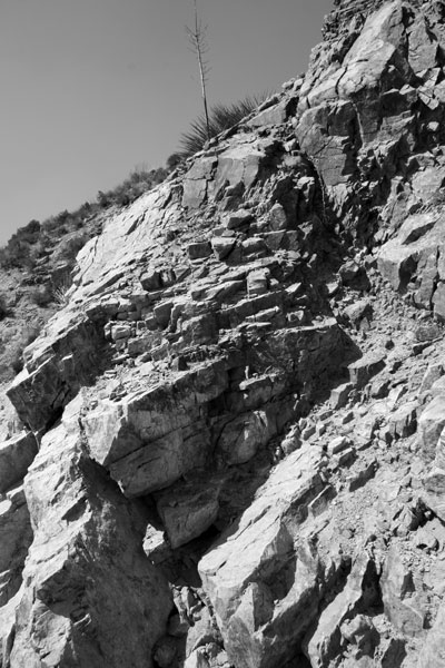
The trail begins north of Sunland, off of Little Topanga Canyon Road. BF and I got a late start (like I really need to point this out anymore), but we had plenty of time to do the 7-mile, 800 foot elevation gain hike. We started out around 2 p.m. by heading down a little fire road. The road heads gently downhill until you find the footpath, which leads you straight down to Dutch Louie Flat, at the base of the canyon.

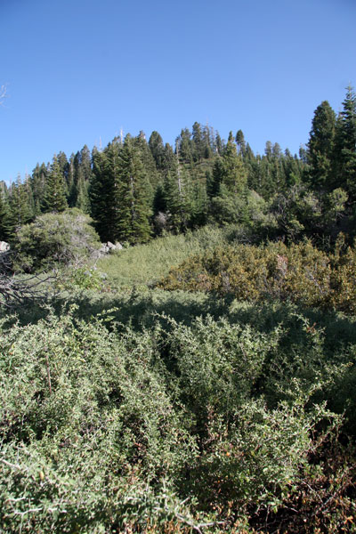
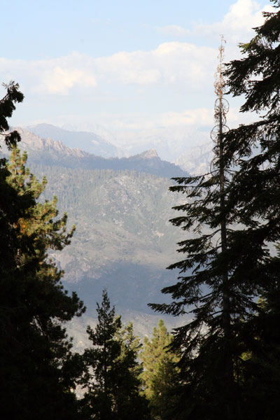
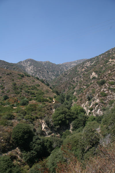
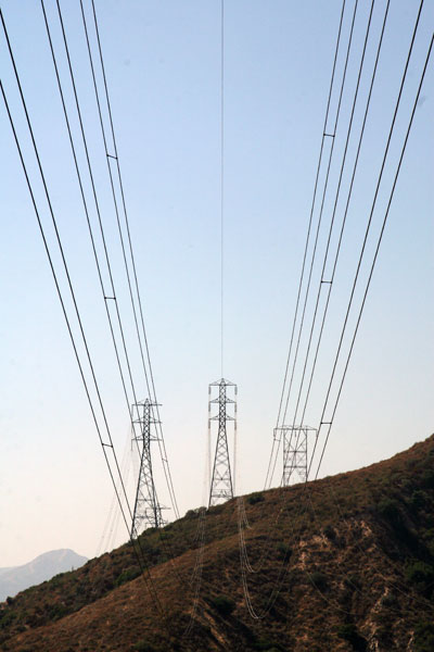
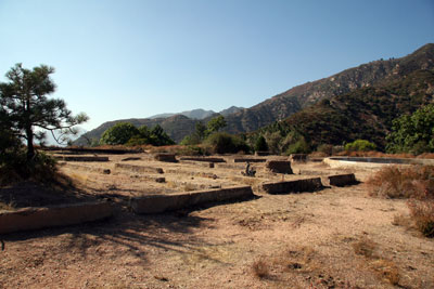
Just as we got started, BF snapped this picture of the hills:

Dillon Divide

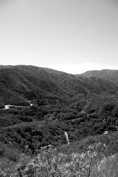
The black & white isn't a stylistic choice—he just didn't realize it was set for monochrome at the time.

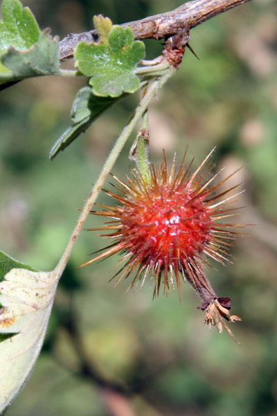
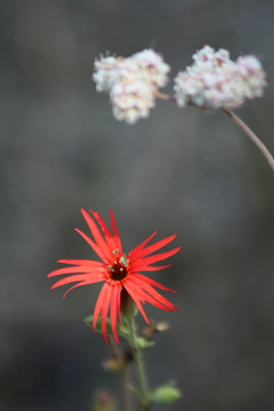
On the way down, I admired the abundance of this pretty red-orange plant:

Red plant

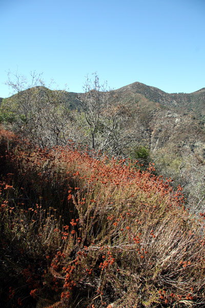
It really was all over the place, and it looked like a Southern California version of New England Fall leaves. In fact, the weather had cooled down during the last week, and I felt a distinct sense that Fall was right around the corner. However, the beginning of our hike was decidedly hot, and we were glad to descend into the shade of the canyon below.

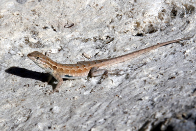
Once down at Dutch Louie Flat, the first thing we noticed was the lack of any water in the streambed. Our book had promised a all-year stream flowing through the canyon. Instead, we found a rocky river bed covered in a layer of gray, dried-out algae. This lizard was chilling on top of said algae:

Little Lizard

BF and I continued along, alternately hiking in the riverbed and along an indistinct path that wandered to and fro from the nonexistent stream. From the moment we arrived at Dutch Louie Flat, our hiking options were limited to climbing over large rocks or walking in soft sand. Neither choice was ideal, and the hike felt twice as difficult because of the uneven terrain. I knew I'd be sore the next day in all those weird side-leg muscles I never use during regular walking. (I was right.)

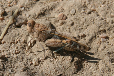
As we hobbled along, I suddenly saw this monster of a bug flying at my head:
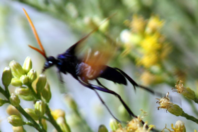
Tarantula Hawk In Flight

Aahh!

Tarantula Hawk in Flight

I screamed and ducked in the calmest way possible when a two-inch insect is hurtling towards your head. I believe I exclaimed "oh, damn!" as it flew towards me. Luckily, it passed me by and disappeared around the next bend. BF hadn't seen this bug, and when I described it to him he was incredulous. It probably wasn't that gnarly, I was just being girly, he figured.

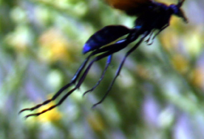
So we moved on, hiking around the bend from whence the monster bug came, and discovered a sunny clearing dotted with pretty yellow flowering bushes. As we walked around exploring, I came very close to one of these flowering bushes and heard loud buzzing noises. I scuttled away quickly when I realized that the buzzing noise was emanating from a large beehive embedded in the center of the bush. When I was relatively certain that the bees weren't coming after me, I took a look around and realized that most of the bushes were covered in stinging, airborne insect life.

On one bush in particular, there was not just one monster bug, but probably a dozen of them. BF and I kept a safe distance away as he whipped out his telephoto lens:

Tarantula Hawk

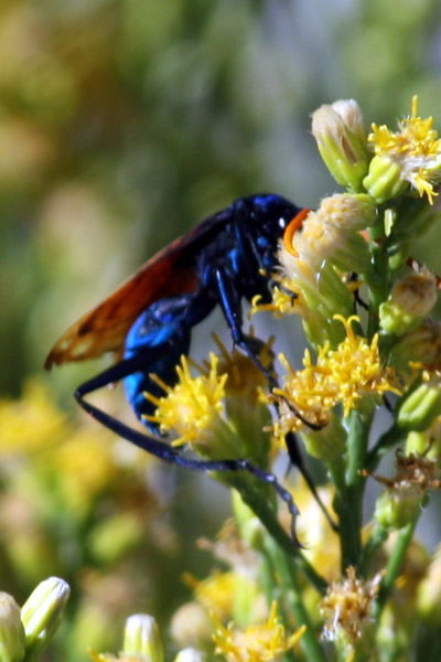
He took about 30 pictures of these critters, many of which are actually in focus. But I chose this shot because it captures the color of the bug well—shiny blue body and bright rust-colored wings.

When BF got home, he immediately did some research and discovered that the monster bugs were in fact called "tarantula hawks." Essentially, these are big wasps that hunt tarantulas. They hunt tarantulas, people! How hardcore is that?

Of course, as BF noted later in the safety of our home, the presence of so many tarantula hawks indicated the presence of tarantulas. Had we seen a tarantula, we might have been even more freaked out. (Author's note: I do realize that tarantulas aren't particularly poisonous to humans. Nonetheless, they still are big, hairy spiders, which is justification enough for me to run away from them.)

The other interesting thing about the tarantula hawk is its incredibly painful sting. For your consideration: an entomologist named Justin O. Schmidt ranks it near the top of his eponymous Sting Pain Index. His description of the pain is as follows: "Blinding, fierce, shockingly electric. A running hair drier has been dropped into your bubble bath (if you get stung by one you might as well lie down and scream)."

If BF and I had known this, we may have stepped back a few feet.

Once we had had our fill of the tarantula-eating insect, BF and I decided to keep heading down the canyon. We were almost ready to abandon our plan of finding landmarks described in the hiking book (an old tunnel, something called "Dagger Flat") but we just decided to keep going until we were certain we'd never come to an identifiable spot and then turn around.

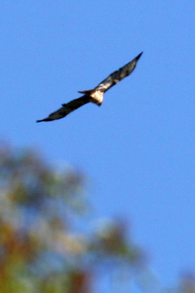
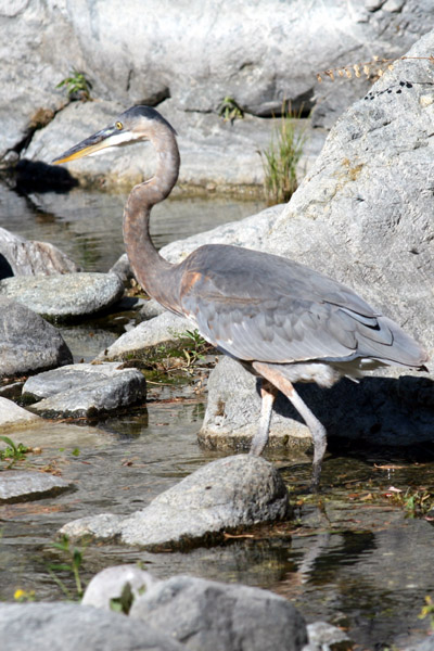
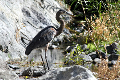
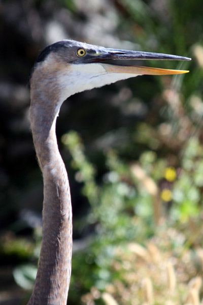
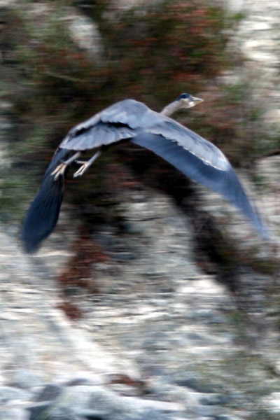
We were both very glad we continued on, because shortly we came upon an awesome sight. There was a small pool of water with a little stream feeding it—what appeared to be the last remains of the stream—and standing in the pool was a huge bird:

bird_profile.jpg

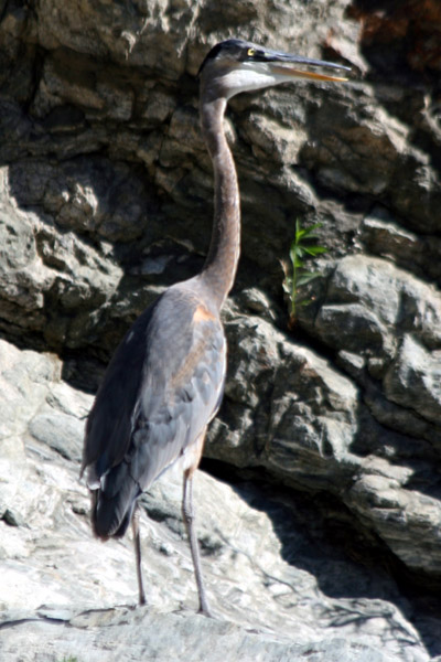
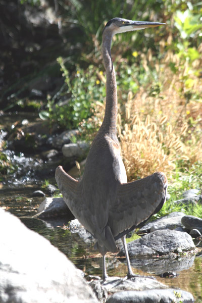
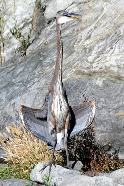
BF and I stealthily approached it, and snapped a million pictures of it going about its business. Here are some highlights:

bird_in_water2.jpg

bird_in_water.jpg

Blue Heron?

bird.jpg

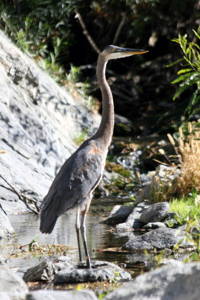
As we got closer, the bird fanned out its wings and stood up very straight. We're still not sure if this was a defensive stance or if it was just trying to warm itself in the sun:

bird_sunning.jpg

Bird in the Sun

It was difficult to tear ourselves away from the bird, but we finally decided we had bothered it enough, and we moved on. We went another half mile before we finally gave up hope of the tunnel or Dagger Flat. BF claims he saw a deer, but it ran off before I could spot it.

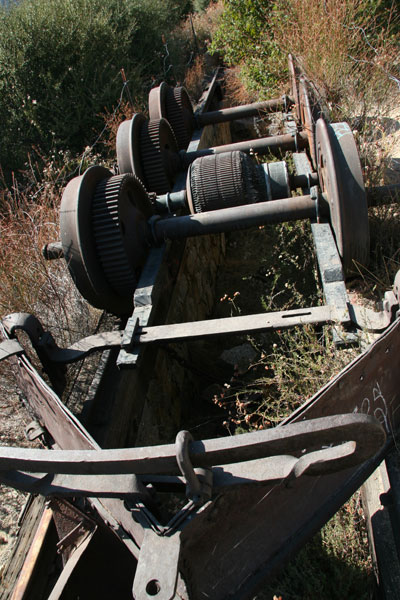
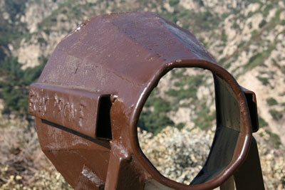
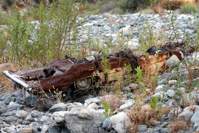
One thing we did find a lot of was shotgun shells. They were scattered evenly all along the trail route. I'm not sure who was firing a shotgun out here, and I was not eager to run into a gun-toting maniac, so I was happy to head back out of the canyon. BF thought they might have been shooting at this old, rusted-out car:

Rusted Car

Back at our pool, our bird friend was still there. As we walked, it decided it had had enough of us, and it flew away:

bird_flying.jpg

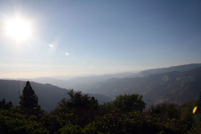
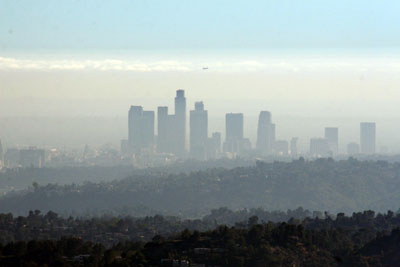
And so we headed back, keeping an eye out for the apocryphal tunnel. (We never found it.) The last leg of the hike was the uphill slog back up to Dillon Divide. I had to take it a bit slowly, but it wasn't as brutal as I had anticipated. Once up at the fire road, the sun started to set behind the lingering forest-fire smoke:

Sunset through smoke

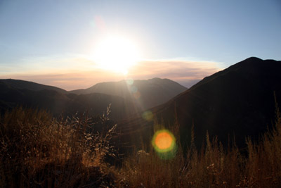
BF and I considered staying later to get a shot of the sun as it turned fire-engine red behind the smoke, but we were ready to get back to the car. We were both hungry, and we could hear In-N-Out calling our names. So we found the end of the trail and headed back down to the L.A. basin, but not without picking up some animal style burgers first.


Blogged: September 11, 2006

Boole Tree - Sequoia Nat'l Park

Hiked September 2, 2006


BF's sister, NM, visited us last week. She is a NICU nurse in Erie, PA, and she was interested in visiting a bona-fide children's hospital, so we took a trip up to Fresno so she could check out my dad's workplace, Children's Hospital Central California.

We also decided to show NM some of Sequoia National Park. NM wasn't quite in a state to hike long distances, so we chose a shorter hike. We decided to hike to Boole Tree, theoretically the largest tree (by volume) in any national forest. This is theoretical, because different sources give me different data. Our hiking book said it was the largest, but Wikipedia claims it's the 6th-largest, and yet another web site says it's the 8th-largest. Bottom line: it's a freakin' big ass tree. Excuse my lack of literary prowess, but that's the truth.

So Dad, BF, NM, and I drove up to the park, less than two hours outside of Fresno. The hike was supposed to be an out-and-back two miler according to our hiking book. When we got to the trailhead, we saw that we could instead do a 2.5 mile loop that would provide nice views of Kings Canyon. We opted for the extra half mile and the better views.

At the start of the trail, you climb almost the entire 600 feet in a mile. The scene is very pastoral at the beginning:

trail

And a cool piece of flora BF spotted:

firework_plant

As you head up the hill, the woods get thicker and the sunlight filters through all the big trees. Just when it was starting to get really dark, we came to a fork in the trail and saw a sign pointing to the right. It said "Trail". We debated the meaning of this sign for a few moments before BF ran ahead to check things out. When he returned, we all agreed that "Trail" was to be interpreted as "Trail spur to go see the Boole Tree."

For once, we were actually right in our trail navigation. We followed the spur a few hundred feet to find the massive Boole Tree. According to the mostly-trustworthy Wikipedia, the Boole tree is 268.8 feet high and 113 feet in circumference. In volumetric terms, that's 317,733 gallons. My car could travel 9,531,990 miles on that!

Look at NM and myself standing in front of the tree, and you'll believe it's huge (I'm the one pointing to the heavens):

look_up

Because the tree is so large, it's not very easy to photograph. Never afraid of a challenge, BF stepped up with his digital SLR and shot away. This is a pretty cool shot up through a charred hole in the side of the tree:

boole_up

Giant Sequoias have a unique ability to survive forest fires. Seeing as they live thousands of years, this is a necessary trait. The reason they can have charred-out insides and still persevere is because of the way they transport water from their roots to their leaves. Essentially, all a Giant Sequoia needs to survive is a few inches of its outer rings (and enough of a root system to keep it from toppling over). This is why many Giant Sequoia trees have large burned portions on their trunks.

BF decided to do a sideways panorama of the tree. He took a bunch of pics and stitched them together, to get this awesomely distorted shot:

boole_stitched

Having circled the tree a few times, we all decided to get on with our hike. We looped around and got a cool view of beautiful Kings Canyon:

kings_canyon

It was a hazy day, so the next huge vista we got wasn't particularly camera-friendly, but it was beautiful nonetheless:

vista

We were back at the car before we knew it, and with daylight fading, we decided to visit the sequoia grove to see some more massive trees. BF caught the sunset reflecting off the Oregon Tree:

oregon_tree

Once the sun set, we headed back to Fresno. We stopped over at my stepmom's house to eat some Thai takeout (NM can't get Thai food in Erie, so she was very excited about this meal) and hang out with my stepbrothers. Incidentally, my stepmom introduced me to a wonderful new dessert. It involves hollowing out a strawberry, pouring butterscotch schnapps into the cavity, topping it with whipped cream, and popping the whole concoction into your mouth. I highly recommend it.


Blogged: September 6, 2006

Echo Mountain

Hiked August 26, 2006


BF and I chose this trail after I returned from flute choir. I had wanted to do an easy hike because I was recovering from a case of strep throat—I was still feeling a bit out of it, and a long hike wasn't in the cards. I also needed to do a short hike because my friend Shanna and I were heading to the American Idols Live concert that night.

If you're wondering why Shanna doesn't get to be anonymous on my blog, it's because she has her own blog called "Out of My Head" (linked in the right column) where she has already revealed her secret identity.

Anyway, for the sake of saving my infection-ridden self and making it in time to hear Elliott Yamin sing "Trouble", BF and I chose to hike Echo Mountain, just north of Pasadena.

It was a hot day in Los Angeles, and the views were not exactly clear. There are days in L.A. when you can see from the mountains to the ocean with perfect clarity. This was not one of those days. Instead, the city was hazy with smog.

smoggy_losangeles

It made me want to cough. I thought of all the particulate matter that I was inhaling, and suddenly I yearned for Yosemite again. But we were stuck in Los Angeles, and we were going to hike through the smog even if it killed us!

After a little puttering around trying to find the right trailhead, BF and I stumbled across a plaque detailing the hike. Here I am looking over it:

trail_info

The plaque informed me that at the turn of the 20th century, some very industrious individuals built a railway and a large complex of buildings at the top of Echo Mountain. I've borrowed the following picture from Peter J. McClosky's site:


He has a lot of cool pictures of the railway, the observatory, and the whole Echo Mountain site.

Before I get ahead of myself, let me talk about the hike. Basically, the hike is just switchbacks straight up to the mountaintop. There is very little shade, which was pretty brutal on such a hot day. Ascending 1400 feet in 2.5 miles was surprisingly strenuous for me. I suppose I should have known it would be, but I was expecting it to be a little easier. Of course, I drank a lot of water and just took the hike slowly. In the end, the ruins at the top easily justify the slog uphill.

canyon

About halfway up the hill, you cross under some huge power lines:

power_lines

Being late summer, there weren't a lot of wildflowers, but here's one we found:

pretty_flower

There were a fair amount of hikers coming down the trail as we were going up. Of course, this had to do with our usual late start. Most sane hikers had headed up the hill when it was cooler. However, because most people were coming down, we had the summit mostly to ourselves when we arrived.

BF liked the look of the rock on the mountainside and he got artistic:

artsy_rocks

We also found this dusty grasshopper sitting in the middle of the trail:

grasshopper

Otherwise, the hike up was mostly uneventful. Once we reached the summit, we got a good dose of history. You can read all about it on the Wikipedia entry for the Mount Lowe Railway.

Here are the Clif's Notes: a railway was built in the 1890s to take vacationers up to Echo Mountain, where there was once a casino, observatory, and a big hotel. There were also two large generators to supply the tourists with electric illumination. Unfortunately, in 1905 the wires from said generators got caught up in a wind storm and caused a huge fire that burned down everything but the observatory.

They rebuilt the Echo Mountain House, but the railway was abandoned in 1938 after a string of natural disasters made the whole operation unfeasible.

Now, all that's left is the foundation of the Echo Mountain House and a few pieces of the railway. Here's the remains of the house:

hotel_ruins

A big piece of railroad equipment:

railroad_ruins

And a huge gear for pulling the railcars up the incline (with me standing next to it for scale):

big_wheel

BF also got a little artsy with the gears:

artsy_gears

Another cool artifact is the "echo phone":

echo_phone

Apparently people used to yell through this contraption, and people up on Mount Lowe could yell back through another and they'd have a conversation. It's no RAZR V3, but it's certainly wireless communication.

Having checked out the ruins, BF and I decided to head back down the mountain. It's always amazing to me how much faster you descend on a hike, and this trail was no exception. What took an hour to climb took what seemed like minutes to descend. BF and I knew we had to get back to the car ASAP so I could make my date with Taylor Hicks, so we didn't stop very often. We did stop to get a shot of a circling hawk overhead:

hawk

I suspect it's a red-tail hawk, but I'll have to wait for my brother to confirm this for me. Right now he's in Veracruz, Mexico, counting and identifying hawks for a living, so I always default to his raptor-spotting skills.

We made it back to the car just in time to pick up some In-N-Out Burger, get home, shower, and eat (in that order) before heading off to the concert.

P.S. The concert was great, especially because I got the tickets for $10 each even though the face value was $60. Thank you, eBay.