Little Baldy - Sequoia Nat'l Park
Hiked November 25, 2006
It was the Saturday after Thanksgiving, and BF, dad, and I decided to try and counteract our activities from the previous two days—namely, eating voaciously—and go out for a hike. It was supposed to be a clear day up in the Sierras, and we thought we might be able to get one last hike in before the snowy season. (They call that "Winter" in most places. In Los Angeles, we don't really know what it's all about.)
Because my parents are divorced, I had the good fortune of having two full Thanksgiving meals, one on Thursday and one on Friday. This meant I really needed to hike.
We chose a trail from my dad's book "Best Short Hikes in California's Southern Sierras" called "Little Baldy." Dad said he had hiked it before, and it was a nice little jaunt with great views. The forecast said it would be sunny with highs in the 50s. So we got on the road.
Of course, this being a Hiking L.A. hike, we got a late start. We got on the road by noon, though, with dad driving his Prius and BF snoozing in the backseat.
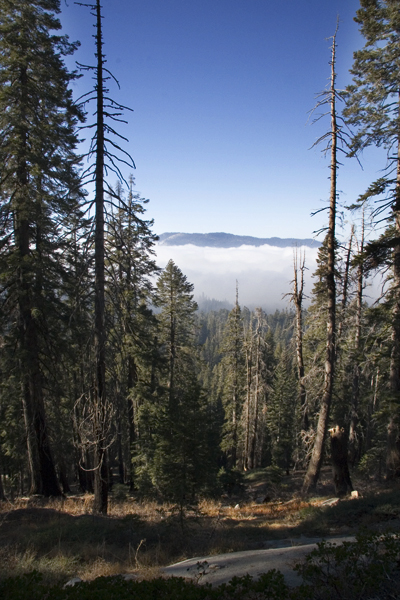
As we headed into the mountains, a huge wall of clouds loomed in the distance. Dad and I started to question the weather.com forecast of "sunny, 54 degrees." Our doubt only grew as we climbed higher and found ourselves deep inside a dense fog.
"Maybe we'll get above the clouds," dad said optimistically.
We got to the split in the road where you turn left to go to Kings Canyon and right to go to Sequoia National Park and it was still foggy. We took a right, and about fifteen minutes later, the sun started shining again. We were above the clouds.
As we kept driving, Dad started to get nervous about finding the trail. He had gone online to find a description of the hike, and had printed out a trail description for a hike called "Big Baldy." It was approximately the same distance and elevation change, but I had a sneaking suspicion that it was a completely different hike. Dad thought it was just people messing up the names. Big Baldy, Little Baldy—they're both bald, right? What difference could it make?
I was convinced, however, that these were two separate hikes. I was even more convinced when we passed a sign on the highway that said "Big Baldy Trailhead" and it didn't match the description from the book at all. Though he didn't really want to drive any further, I convinced dad to keep going so we could find the Little Baldy trailhead.
Of course, at this point dad realized that the last time he hiked what he thought was "Little Baldy," he had instead hiked it's big brother. Then dad really started to get concerned that the hike in the book would be either: 1) too far away, or 2) not a satisfying hike. There was no way to tell. We decided just to give it a chance.
With a little help from the Prius' GPS navigation system, we found the Little Baldy trailhead after a few more miles. We got out of the car to find ourselves in near-freezing weather. I had bundled up before we got in the car, and I came prepared with gloves, my winter hiking jacket, and long johns under my hiking pants. As I was getting dressed that morning, BF made fun of me. He teased me and said "we're not climbing Mount Everest."
But when we stepped into the chilly air, BF had stopped laughing. Luckily, dad had packed extra hats and scarves for the trip. BF wrapped a scarf around his head and neck and pinned it down with a baseball cap. He looked like a low-rent sheik. But it kept him warm.
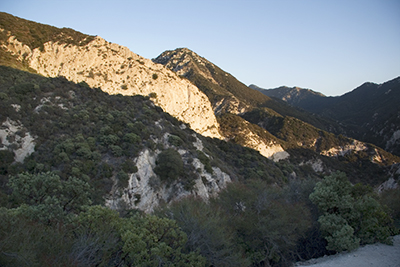
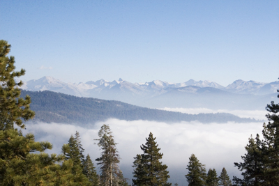
Finally, we started hiking. The hike consists of switchbacks that head from Little Baldy Saddle, at around 7300 feet, to the top of Little Baldy, 8044 feet. The climb was gradual—enough to raise your heart rate but not punishing. On the way up, we started to climb high above the clouds and got some amazing vistas:
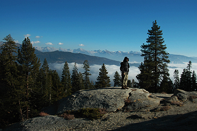
As you head up the mountain, there's a false summit about 500 yards from the real summit. It almost had us fooled, especially since you could see an amazing view of the Pacific Crest from there. Here's BF posing in front of it:
Thankfully, we kept hiking and after another quick jaunt uphill, we arrived at the top of the world:
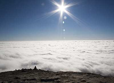
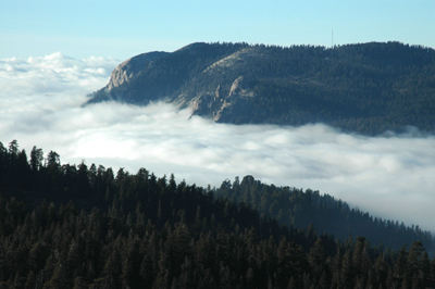
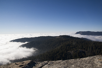
It was hard to believe we weren't at the top of the world. We had a 360-degree view of the Sierras and the sea of clouds over the valley. Here's a picture that dad tells me includes Big Baldy in the distance:
BF had a fun time scaring me by pretending to jump off the side of the mountain. Here's an example of what it looked like, except I'm the one at the ledge:
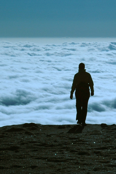
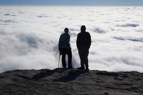
It turns out there was another 100 feet or so of level rock beyond that point. It looks much scarier that it actually was. Here's a rare picture of BF and I together on a hike (usually it's just two of us, and one of us has to be behind the camera):
And here's the Pacific Crest again:
And another vista:
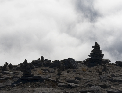
Other hikers had made cairns (or ducks, depending on what you want to call them) and placed them strategically at the edge of the bald summit:
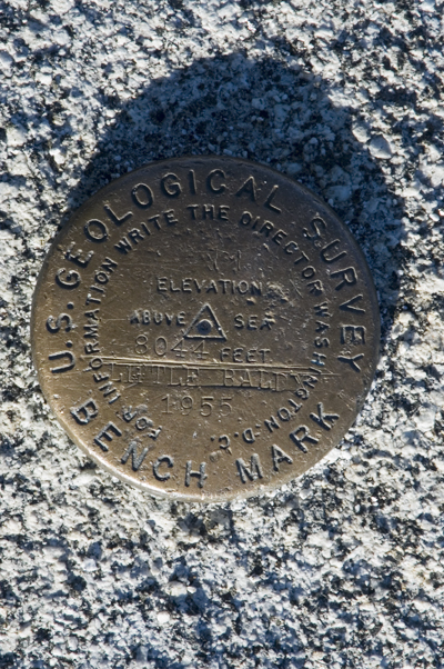
Here's the marker to prove where we were:
The only downside was that it was downright freezing at the summit. The wind was blowing steadily, and it had to be at least ten degrees below freezing. After twenty minutes of soaking in the views, we decided it was time to thaw out.
So we headed back down the mountain, stopping at the false summit to eat some sandwiches. When we got back to the car, the Prius informed us that it was 32 degrees outside. This was at the bottom of the hill. For a L.A. girl, this was beyond cold. We needed to warm up.
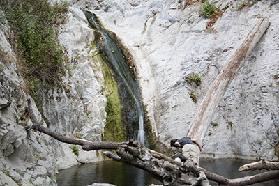
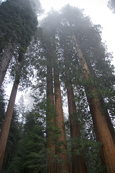
Before we left the park, we stopped at a grove of giant sequoias to take some pictures. It was getting dark, and we were back in the fog, so there was an eerie glow about. BF managed to get a good shot of the trees, still:
We arrived back in Fresno safely, and not long afterwards BF and I gathered up our things and drove back home to Echo Park. Later that week, back in the warmth of sunny SoCal, dad called me to say that we had gone hiking at just the right time. Two days after our hike, the Sierras were hit by the first big snowstorm of the season, and most day hiking trails would be closed for the Winter. We got in just under the wire.
posted by iwriteplays @ 6:21 PM
5 comments
![]()