Towsley Canyon View Trail
Hiked: February 10, 2007
I'm so far behind in updating this blog. I'd feel guilty, except this blog is supposed to be my "fun" writing, so I forbid myself to feel an obligation to update it regularly. That said, I'm secretly giving myself a mental flogging for being a bad blogger.
FAST FACTS:
• Length: 7 miles
• Elevation gain/loss: 1671'
• Location: Near Valencia, CA
• Type of Hike: Loop.
I have a good reason. Really, I do. I'm trying not to reveal too much too soon, but lets just say it involves someone paying me to write. And to knit. I have an actual deadline for this mystery project, and I'm trying not to screw it up. Hence, I've been forcing myself to do nothing but work on said project until I finish.
I've failed in that task, too. In my defense, I needed to give my wrists a break. I've been knitting nonstop for the past few days, and my joints are not happy. I've also watched nine episodes of Veronica Mars on DVD. I really need to go on a hike.
The next best thing to going on an actual hike is blogging about one. So here goes. Lets hope I can remember it...
BF and I decided to go a little further afield than usual for this hike. We saw there were some cool-looking hikes near Valencia, so we hopped in the car and headed up I-5. We decided to do the "long" Towsley Canyon View Trail. Apparently there's a shorter mile-long version you can hike. We didn't see this option because we started the hike at the end. We kept wondering why people were passing us going the opposite direction, but by the time we figured we were hiking backwards we were already halfway done. Oh well, c'est la vie.
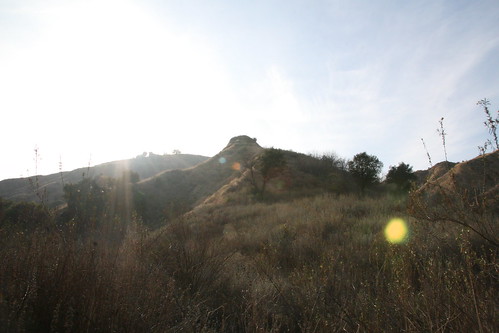
The hike was beautiful. The weather was perfect. See for yourself:
The hike takes you by a few natural tar pits. You can smell them before you see them. At the very beginning of the hike we saw this stream with a steady stream of tar flowing:

The tar got the better of this Aquafina bottle:
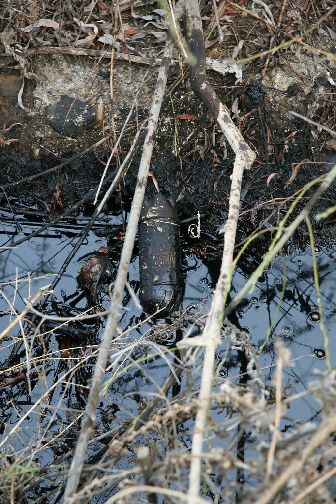
Take that, litter! No plastic bottle is safe in SoCal.
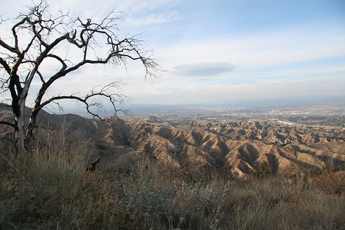
As you gradually head up to the peak, it becomes clear that fire had ravaged the landscape not too long ago. At the peak, we took this picture of a burned tree and the hills in the background:
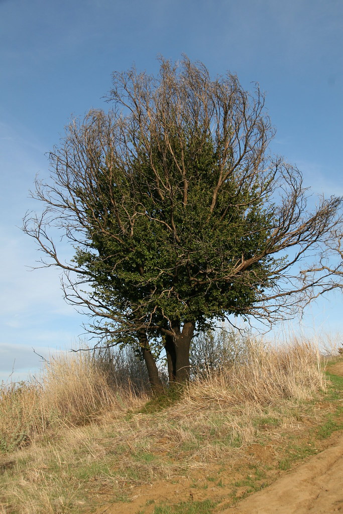
We also saw this cool tree that was coming back from the dead. I call it a "Lazarus Tree," but I'm sure that's not really what it's called:
At the very end of the hike (or the beginning, depending on your trajectory), you reach an canyon area called "the narrows." Once upon a time, it was dangerous to be a rock in "the narrows." There was a big of geological upheaval back in the day. It makes for some cool formations, but they're impossible to photograph. Here was an attempt:
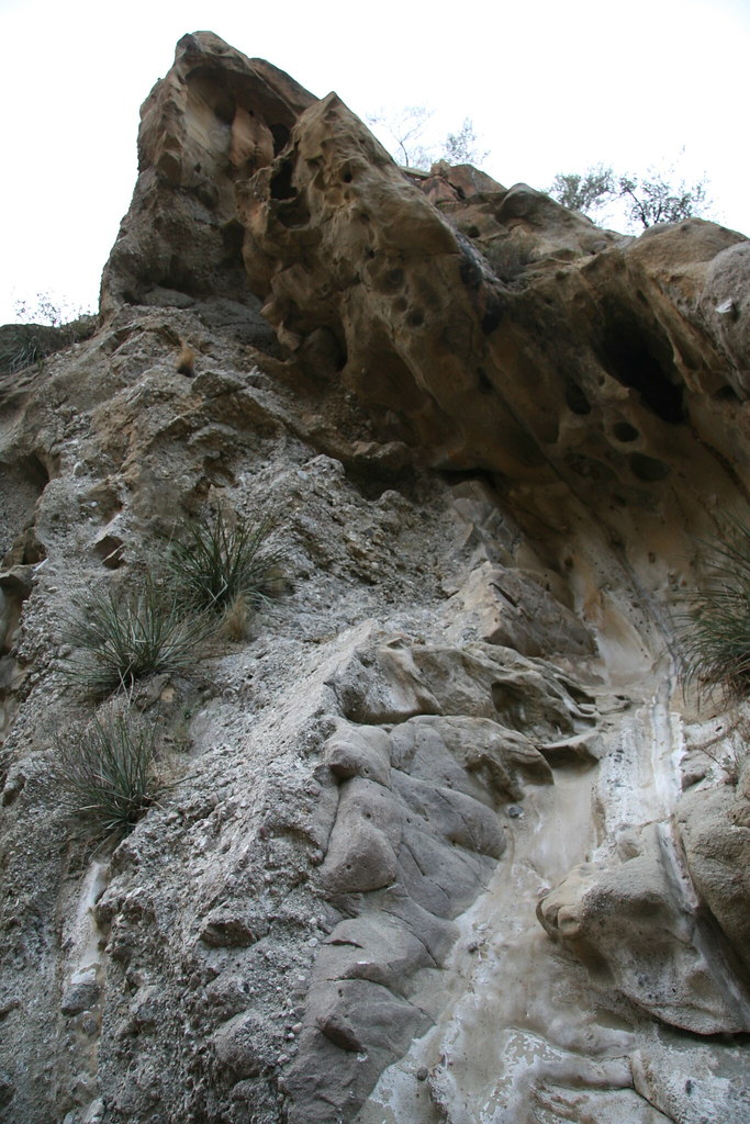
Benign as it looks, it is really big. Flintstones-backdrop big.
Bing, bang, boom. That a blog post. Sadly, it's been over two months since we hiked this trail, so my memory is spotty. I do remember passing by a large family on the summit. They had obviously had a picnic and then decided to hike the trail. More power to them - kids really should venture out of the living room sometimes. (I should take my own advice.)
By the way, I have two more hikes to post. Keep an eye out. The next one's dedicated to Casey from Modern Hiker because he inspired us to hike it. That's all for now. I'm going back to knitting.
Labels: towsley canyon view trail, valencia
posted by iwriteplays @ 1:55 AM
![]()


0 Comments:
Post a Comment
<< Home