Arroyo Seco
Hiked: July 15, 2006
Saturday was the first day of a major heat wave that swept across the entire country. The national weather service had issued a heat advisory for basically all of Southern California. Temperatures in Pasadena were predicted to get as high as 104°F with "increasing humidity." They advised people not to leave neither humans nor pets in cars for any period of time, even with the windows cracked. Remember all those people who forgot their infants in cars a few years back? The national weather service remembers, and they wanted to send out a warning. Stay indoors, they urged. Keep cool. Avoid sun exposure.
What does the national weather service know, anyway? BF and I were determined to go on a hike, heat wave or no heat wave. But where to go?
Rewind to Friday, when BF and I jetted over to the REI in Arcadia to buy new hiking boots. After my Teva debacle on Mt Lowe, I realized my dire need for new boots. BF also was hurting, literally, for new footwear. Just as we returned from our Mt Lowe hike he noticed that both soles on his old boots had separated from the toe. Sure, they had good air flow, but they certainly weren't trail-worthy.
At REI, a very nice fellow bearing the nametag of "Steve N." helped pair us up with the right hiking boots. Initially I was looking at low-rise cross-training shoes, but Steve N. steered me in the right direction. I needed ankle support, he said, or else my feet would slip too much in the shoe. If my feet slipped too much, I would lose my toenails. Seeing as I wear flip-flops almost 100% of the time, I decided having toenails was something I valued. I got the high-ankle boots. Incidentally, BF and I got the exact same boots. We didn't plan it that way, I swear. We're not trying to be the cute hiking couple that has matching gear.
Anyway, Steve N. asked about our hiking plans for Saturday, and we told him we were still undecided. He immediately recommended the Arroyo Seco trail, just north of Pasadena. He said it was shaded and by a river. A cool hike was promised---double entendre intended.
After REI, we stopped at Trader Joes to pick up some Clif bars. I mention this because I have now discovered my favorite on-trail snack: the Clif Nectar bar. A mere $0.99 at Trader Joes, this bar is tastiness in stick form. I'm not a health-food nut, nor do I particularly care if my produce is organic or pesticide-ridden. I probably should care, but I can't seem to muster up the energy to take on a new cause. What I do care about is taste. I tried the LARABAR once and I nearly spit it out. It may have been organic and raw and whatnot, but it just didn't taste good. The Clif Nectar bar, on the other hand, is delicious. I highly recommend picking one up before your next hike.
Now we're back to Saturday. I had a flute choir rehearsal to attend in the morning, so I wasn't free until about noon. When I got home, BF and I fired up the grill and made some chicken sandwiches. By the time we had cooked, eaten, and digested properly, it was 3 p.m. I don't know how that happens. Somehow we get into a major time-warp before hikes. Regardless, we managed to get ourselves up off the couch and prepared for Arroyo Seco. I think our motivation had a lot to do with wanting to break in our new hiking boots.
Arroyo Seco is a very popular trail that originates in Altadena. Because of its proximity to the city and the well-kept trails, you see a lot of picnicking families, joggers, and bikers. Luckily, most of these people tend to stick to the paved section of the trail. After about one or two miles, the likelihood of running into another human dwindles significantly.
We arrived at the trailhead at about 4 p.m. The parking lot overlooks CalTech's Jet Propulsion Laboratories. I sure hope I'm not compromising national security by posting this picture:
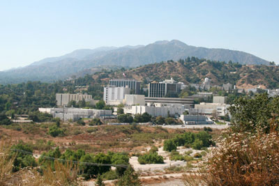
As we walked towards the trailhead, which happens to be the beginning of the Gabrielino trail, we got views of the JPL from many angles. I thought about all the crazy physics going on in those buildings. BF reminded me that physicists probably took Saturday off.
It was hot. There was no question about it. We had three liters of frozen water (a.k.a. "ice") in BF's backpack, as well as 3 more liters of cold liquid-form H2O. At first we thought this was a bit of overkill. Then we started walking the trail. The first mile or so of the trail is all paved road, with little shade. I felt like my face might catch on fire. I felt my pulse in my cheeks like a bass drum - BOOM BOOM BOOM. I started to wonder where this river and shade was that Steve N. had promised. BF and I killed the first 1.5L of water in the first mile. Then we started to wonder if we had enough water for the trip.
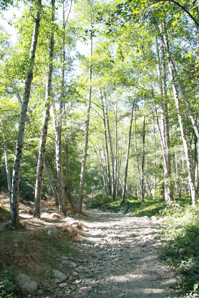
Luckily the trail meandered down to the stream side after about a mile and we were shaded by the beautiful trees. We dipped some scrap cotton fabric (makeshift bandanas, we figured) in the stream and plopped them on our heads. BF and I started to cool down and notice the beautiful scenery:
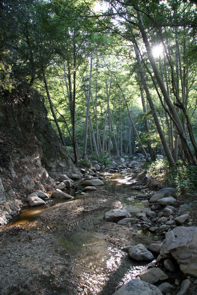
The trail continues along the stream, which was thankfully not true to its Spanish name (arroyo seco translates to "dry stream") and provided us with many scrap-cloth dips along the way. The trail crosses the stream a few times along the way, but all the crossings were very easy to navigate. Here's one:
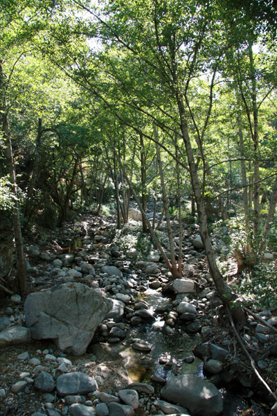
The stream was less-than-mighty at times:
But it was always pretty. Under the trees and by the water, the temperature dropped considerably. It was even pleasant at times. As the sun started to go down, I started to wish I had bug repellant on. I swatted a good number of unidentified buzzing insects away from my face and arms and somehow managed to escape without any mosquito bites. (Writer's note: mosquitoes love me. I'm their meal of choice. To go anywhere without falling victim to these blood-suckers is a major accomplishment for me.)
On the trail, there are a few different landmarks conveniently spaced along the way. There's the Gould Mesa Campground at about 2.5 miles, the Nino picnic area at the 3-mile mark, and then the Paul Little picnic area at mile 4. According to our hiking book, we should have walked an extra mile past the Paul Little picnic area to the Oakwilde campground. The book also mentioned that this section of the trail was a steep climb up the side of a cliff. BF and I decided 8 miles was plenty and turned around.
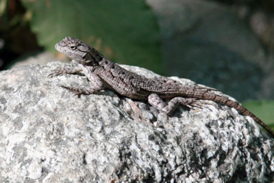
We did see a deer on this trip, but it didn't stick around like the one on Hoegee's Loop, so we have no pictures as proof. We did see a lot of lizards, as usual, and got a shot of this one as it was doing push ups:
We also had a rabbit run across the trail. All in all, it was a good day for wildlife. Still no cougars, though. (Is that a good or a bad thing?)
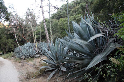
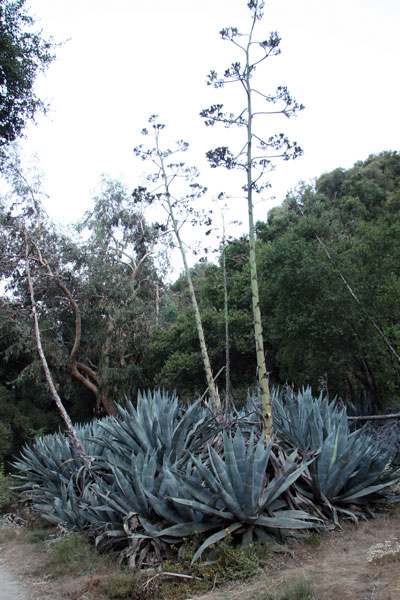
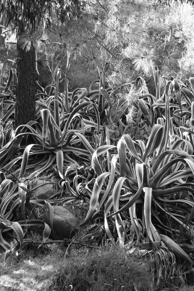
Apparently the Arroyo Seco trail used to be occupied by lots of resort cabins in the 1930s. Now you can only spot the stone foundations and the occasional wall. The real impact of these cabins is all the non-native flora that still thrives along the trail. We were told to look for agave plants. We think these are agave---they look a lot like century plants, but they're MUCH bigger:
We also saw quite a few eucalyptus trees. We didn't bother taking a picture of them, but we did take some shots of this weird and colorful plant:
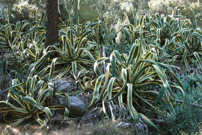
I have no idea what it is (I'm sure someone more educated in botany can identify it for me), but it was crazy colorful and had spines. BF was getting artistic with his digital SLR here:
By the time we got back to the paved portion of the trail, the sun had disappeared behind the Jet Propulsion Laboratory. In the end, we only drank three liters of water plus a sample of the partially-frozen bottle. We survived sans heat stroke. It was a successful trip.
Summary Judgment
Nice trail, though the beginning is a little boring and hot. May be too crowded for comfort on holidays. Easy, with very little elevation gain and only basic trail-navigating skills needed.
posted by iwriteplays @ 1:49 PM
![]()


1 Comments:
This hike sounds pretty cool.
I like the photoshopped picture of the plants.
Post a Comment
<< Home