Grizzly Flat
Hiked October 15, 2006
Angeles Crest Highway to Grizzly Flat and Vasquez Creek via Upper Dark Canyon Trail
After three weekends without hiking, BF and I were itching to get back out on the trail. The gods of scheduling had spitefully kept us from the mountains for far too long. First it was a trip to Wisconsin to attend a friend's wedding. Then BF's parents were in town for two weekends in a row, further preventing us from running off to the woods.
While BF's parents were in town, we did take them to walk around downtown Los Angeles. As we were touring around, it occurred to me that a walk through downtown L.A. could actually be considered a legitimate hike. There's significant elevation change (if you plan your route properly) and a lots of interesting scenery. For example, you could visit the Disney Concert Hall:
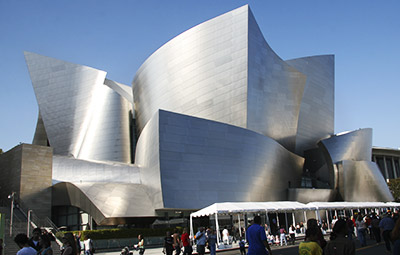
Only Frank Gehry could have designed a building like this. The inside of the concert hall supposedly has the best acoustics of any new building in the world. It also has an amazing organ completely integrated into the design of the back wall.
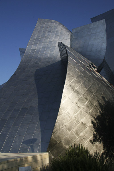
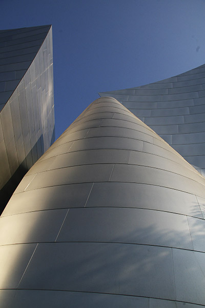
The other great thing about Disney Hall is that you can walk all around the structure, up and down stairways and around the curved metal. Here are some pics from around the building:
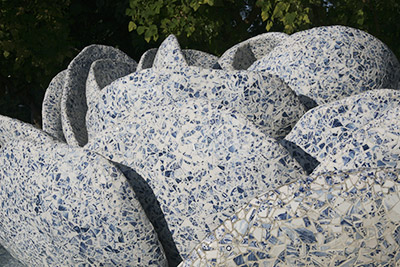
There's a garden terrace on the back side of the building, where Gehry designed this really cool flower fountain. It's made completely out of broken china:
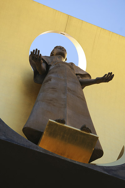
When you're downtown, you can also visit the Cathedral of Our Lady of the Angels. The architecture is very modern and quite different from most Catholic cathedrals you'll encounter. Standing over the entrance to the chapel is this statue:
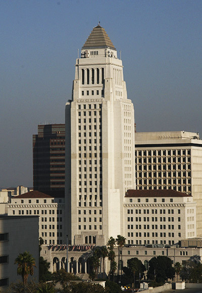
Then go on to check out L.A. City Hall. Dragnet, anyone?
Onto hiking in the actual wilderness. On Saturday night, my girl friends had arranged a middle-school-style sleepover, complete with mud masques, sleeping bags, and cute PJs. Of course, we added a little vodka and rum to the equation. This resulted in a very fun and relaxing evening. Of course, the next morning I was suffering the inescapable effects of drinking and then only sleeping for four hours.
Around noon, the girls and I went to breakfast and I tended to my throbbing head with a good dose of bacon, coffee, and ibuprofen. Then I drove myself back home to a waiting BF.
BF was slightly irritated that I hadn't called him earlier. He had woken up at 9:30 because he wasn't sure when we'd be taking off to hike. I arrived home around 1:30 in the afternoon. I needed to lie down on the couch.
After about an hour of lounging around, BF inquired whether we'd be hiking at all. I replied in a noncommittal manner. Then BF rightfully put me in my place and properly shamed me into getting off my hungover rear end. It had been almost a month since we had gone hiking, he argued, and we really needed to get back out there. I grudgingly agreed, and so I peeled myself off the couch.
I picked a hike relatively close by, only 6 miles north of La Canada on the Angeles Crest Highway. Even so, we didn't arrive at the trailhead until 4 p.m. This was pushing it even for us. However, the trail was listed as "easy" in our guidebook, and it was only 4.5 miles long, so we figured we could easily get back before sundown around 6:30.
The trail begins right off the road, and it heads straight up the hill with a very steep grade. In less than a half mile, you climb about 500 feet.
The weather had changed significantly during the past three weeks. On Friday the 13th, it had poured rain throughout Los Angeles for the first time this season. When we arrived at the trailhead, it was overcast and legitimately chilly. I loved it. I was so ready for the sweltering summer to be over and to have some temperate conditions to climb in.
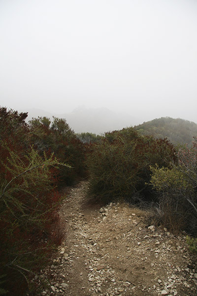
Once we started up the trail, we quickly walked into a very light fog. We could see the trail ahead of us, but not much of the surrounding wilderness.
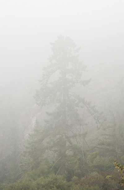
It was eerie and wonderful. Here's a big tree hiding in the fog:
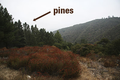
It wasn't great for taking pictures, though, so we didn't bother with too many. As we got to the top of the first climb, we arrived at a pine plantation—apparently the forest service used to repopulate burned-out forest here with pine trees. They look very out of place.
After the first group of pines, you descend along a fire road toward Grizzly Flat, where you encounter another pine plantation. Here's a pic:
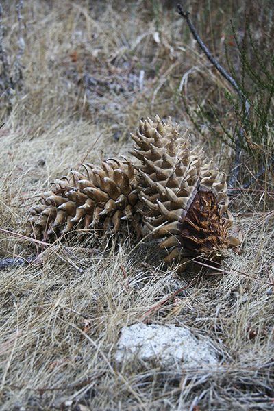
The pinecones dropped by these trees are extra-sharp and pointy. I found them interesting:
BF and I tried to take a side-trail to go find Vasquez Creek, but after about a half mile of descending and no creek to be found, we decided to turn back. We've seen creeks before. We needed to get back to the car before the sun set, and we had a lot of climbing to do.
Turning around, I huffed and puffed my way back up the trail. It turns out that there were almost no flat parts to this trail - you were always climbing or descending. I had just recently recovered from a nasty bout with Mr. Common Cold, so my climbing speed was even slower than normal.
However, I made it back up to the first pine plantation much easier than expected, and BF and I walked straight into some very dense fog. It made me think of Halloween. I love the mood overcast skies and dense fog creates. But I digress.
BF and I descended the final stretch very quickly. I had a flashlight in my hand, but it was more for insurance than for actual illumination. We arrived back at the car by 6:30, with plenty of daylight to spare.
posted by iwriteplays @ 4:49 PM
2 comments
![]()

