Mount Islip
Hiked: July 22, 2006
What is it they say about the best laid plans of mice and men?
For the first time since we began our foray into hiking L.A., BF and I actually picked out our hike at least 12 hours in advance. Our friend EVG had expressed interest in joining us this week, so we figured we should know where we'd be hiking ahead of time. On Friday night we picked out the northern approach to Mount Islip and called EVG up to confirm his participation.
Part of the reason why we picked Mount Islip was because it was advertised as a relatively easy stroll. Only 5 miles and 1250 feet of elevation gain, it should have been a quick and painless hike. We wanted to make it easy because, to quote BF, "we don't want to kill EVG." See, EVG is a fellow writer, which is usually enough to make a person out of shape. (All that sitting in front of computer, staring at the blank document...) But not only is EVG a writer (and a good one, at that), he is also a heavy smoker. Rather than ravage his lungs with a death march, we decided on a short jaunt in the woods.
Like usual, BF and I slept in too late on Saturday morning. In fact, we never saw the morning, finally dragging ourselves out of bed just after noon. We called EVG, whipped together some breakfast, and started to prepare for the hike. For me, this usually means slathering myself in SPF 60 sunscreen. For BF, it means packing the backpack full of our frozen water bottles and energy bars.
Just as EVG arrived at our apartment, so did our landlord. She had mentioned that she wanted to swing by and check out our ant infestation, but I didn't expect her to arrive quite so soon. Our apartment was a complete mess, which was embarrassing enough, but then I realized that I hadn't told her about our foster cats. I was worried she would think we were trashing the apartment (with the help of two homeless siamese cats), but she seemed relatively nonchalant about the disaster that was our living room.
After our landlord had seen enough of the ants, we finally headed off on our trip. As usual, it was 3 p.m. by the time we left. Because we had to take the Angeles Crest highway more than 40 miles, it would be another hour before we got to our destination. Or so we thought.
We were supposed to find the trailhead at mile marker 65.5 on the highway. As we drove along, we gained elevation quickly and soon were seeing pine trees and new landscapes. I drove happily along, EVG and BF chatting away, looking out for mile 65.5.
And then we hit a road block---literally. At mile 61, the road was completely closed off with large metal gates. Unsure of what to do, we parked and BF ran ahead to see if the trailhead was close by. A few minutes later, he ran back and told us we were just around the corner from the Pacific Crest Trail. We consulted the map and saw that taking the PCT would just add 2 miles to the trip, and rather than turn around and find a new trail, we went ahead to find the PCT.
Here's where things really started to go awry. Because the Pacific Crest Trail is 2650 miles long, we weren't sure exactly what portion of this trail we were jumping on. Sure, the sign said "PCT", but it turns out we were actually four miles from the real trailhead.
The trail we found simply took us about a mile over a small hill and then deposited us back on the closed highway. Back on the highway, we decided to just keep walking along the road until we found our trail. I think we all knew it was still three miles away, but we were in denial. Personally, I thought we'd just walk along the highway until we got bored and then walk back. Who needs Mt. Islip?
It was definitely eerie to be on the highway all alone. EVG and BF agreed that it was like The Stand. The creepiness factor increased when we arrived at two long, dark tunnels. BF walked ahead of EVG and I, and I got this shot of him:
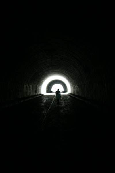
"Go towards the light, Carol Ann!"
When we made it through the empty tunnels, we were treated to a lovely view:
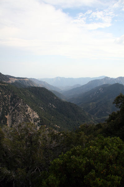
It was the first time hiking around L.A. where I truly felt isolated. We were so high up the mountain that the landscape and foliage was completely different. Luckily, so was the weather. Though mother nature was breaking records in the L.A. basin with 100°+ weather, up in the mountains it was cool and breezy. It was also quickly turning overcast.
Before we left for the hike, as I was filling up my gas tank in Echo Park, I pointed up at the clouds in the distance. I told EVG and BF that those were developing thunderheads. I also told them we'd get rained on. They didn't believe me.
Fast-forward to approximately 6 p.m. and we were walking steadily into the shadow of thunderclouds. Still skeptical, BF and EVG pressed on to find the trail. Finally, after three miles of steadily-uphill climbing on the abandoned highway, we found the trailhead.
From the trailhead we were supposed to hike about 2.5 miles to the top of Mt. Islip, 1250 feet above us, and then return from whence we came. I was already trying to veto actually making it to the summit when we heard the first claps of lightning. Unfazed, EVG and BF kept climbing, and I followed.
We dubbed the beginning of the trail "the pinecone highway". Here's why:
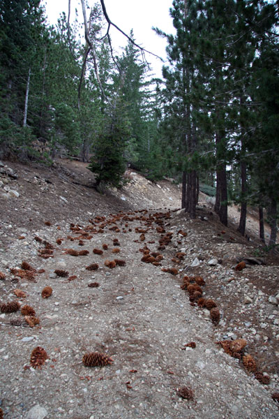
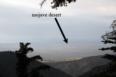
The air was sweet with the smell of pine trees when the rain started to fall. It was just a few drops here and there, so we kept going. At the top of the pinecone highway, where the trail turned towards Little Jimmy Campground, we got a good view of the mojave desert below us:
We pressed on. We heard the thunder get louder and louder, and soon we were seeing the flashes of lightning. We counted the seconds between flash and thunder, and we figured the storm was still a mile away. This chipmunk seemed unperturbed by the thunder:
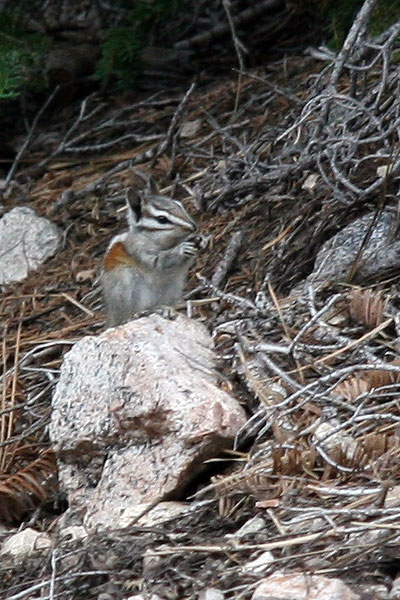
I, on the other hand, was getting paranoid. I love a good thunderstorm, but I prefer to watch them from low ground and under shelter. We were heading to the summit of a mountain. It was also getting late, and the sun would be going down around 8:30. The rain was getting more intense, and I was only wearing a tank top and shorts. EVG and BF weren't any better clothed than me.
When we arrived at Little Jimmy campground (about 1.5 miles from the trailhead), there were about four people already there with their tents set up and a campfire blazing. Just as we rounded the corner to greet the campers, we saw a bright flash of lightning followed immediately by a deafening thunderclap. Even the campers looked stunned. That one was close. The rain intensified, and we were soon soaked. It was 7:30. We were on the dark side of the mountain. If we were to try and make the summit, we'd be hiking the whole trail back down in the dark. BF had a headlamp, but EVG and I had no flashlights.
Though BF and EVG were set on the idea of hiking up to the summit, I had to veto it. After explaining myself, EVG and BF both realized that the responsible thing to do was to hike back down. Mt. Islip would have to wait for another day.
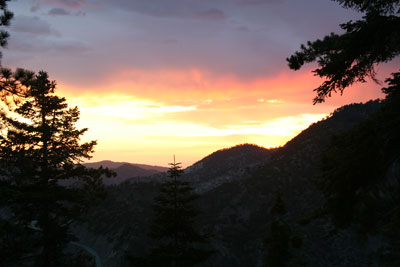
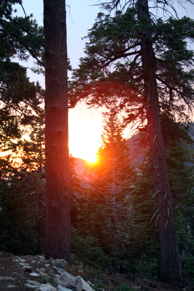
On the way down, the sun started to set. Rather than go back to the trailhead, we took the PCT an extra mile back down to the road. It saved us a little mileage and turned out to be the highlight of the trip. The following shots were both taken as the sun set on the PCT:
We arrived back on the abandoned highway just as it became too dark to see where we were walking. BF whipped out his headlamp and we headed back the three miles to our car. From the road, we got a perfect view of a great thunderstorm over the L.A. basin. We could see whole strokes of lightning, from cloud to ground.
Walking back through the abandoned tunnels in the dark was undoubtedly creepy. EVG, being a horror writer, wanted BF to turn off his headlamp so we could walk in the dark. Figuring that not walking into the tunnel walls was more important than giving EVG new writing material, BF kept his light on. Even with the headlamp, I have to admit that I looked behind me a few times, half expecting to see an apparition trailing us.
After we made it through the tunnels alive, the walk back to the car was all anticipation. All in all, our short 5 mile hike turned into an 11-mile trek. All three of us were ecstatic to see the car again. EVG had a cigarette, BF took his heavy backpack off, and I sat down in the driver's seat, relieved to be off my feet. We were done.
And we didn't kill EVG.


1 Comments:
Hey 'Uwrite',
Just found your blog yesterday. Great pics and narration.
Mt. Islip is one of my favorite hikes in the San Gabriels. Nearby Mt. Williamson has a similarly great view, more of the desert, and an adjacent ridge to walk along.
Just past past Little Jimmy Campground, at Windy Gap, you can alternately turn east and go up to Mt. Hawkins and/or Throop Peak. The ridge between the two give great views of Baden-Powell and Baldy.
I enjoyed your account of the extra distance you incurred because of the road closure. I had to make the extra trek twice (and across the short Kratka Ridge section) on our way to Mt. Williamson. That road closure is now open, however you should know that the road between Islip Saddle (the normal trail head for Mt. Islip) is closed all the way to the trailhead area for Baden-Powell. I have heard that this may remain closed permanently, due to heavy winter storm damage several years ago.
This is what happened to Route 39 which came up to Islip Saddle from Monrovia. And ... also what happened long ago along the East Fork of the SG River. This would be a good hike for you to do, as it takes you to the famous and surreal Bridge to Nowhere.
Post a Comment
<< Home