Hiking L.A.

Blogged: July 26, 2006

Mount Islip

Hiked: July 22, 2006


What is it they say about the best laid plans of mice and men?

For the first time since we began our foray into hiking L.A., BF and I actually picked out our hike at least 12 hours in advance. Our friend EVG had expressed interest in joining us this week, so we figured we should know where we'd be hiking ahead of time. On Friday night we picked out the northern approach to Mount Islip and called EVG up to confirm his participation.

Part of the reason why we picked Mount Islip was because it was advertised as a relatively easy stroll. Only 5 miles and 1250 feet of elevation gain, it should have been a quick and painless hike. We wanted to make it easy because, to quote BF, "we don't want to kill EVG." See, EVG is a fellow writer, which is usually enough to make a person out of shape. (All that sitting in front of computer, staring at the blank document...) But not only is EVG a writer (and a good one, at that), he is also a heavy smoker. Rather than ravage his lungs with a death march, we decided on a short jaunt in the woods.

Like usual, BF and I slept in too late on Saturday morning. In fact, we never saw the morning, finally dragging ourselves out of bed just after noon. We called EVG, whipped together some breakfast, and started to prepare for the hike. For me, this usually means slathering myself in SPF 60 sunscreen. For BF, it means packing the backpack full of our frozen water bottles and energy bars.

Just as EVG arrived at our apartment, so did our landlord. She had mentioned that she wanted to swing by and check out our ant infestation, but I didn't expect her to arrive quite so soon. Our apartment was a complete mess, which was embarrassing enough, but then I realized that I hadn't told her about our foster cats. I was worried she would think we were trashing the apartment (with the help of two homeless siamese cats), but she seemed relatively nonchalant about the disaster that was our living room.

After our landlord had seen enough of the ants, we finally headed off on our trip. As usual, it was 3 p.m. by the time we left. Because we had to take the Angeles Crest highway more than 40 miles, it would be another hour before we got to our destination. Or so we thought.

We were supposed to find the trailhead at mile marker 65.5 on the highway. As we drove along, we gained elevation quickly and soon were seeing pine trees and new landscapes. I drove happily along, EVG and BF chatting away, looking out for mile 65.5.

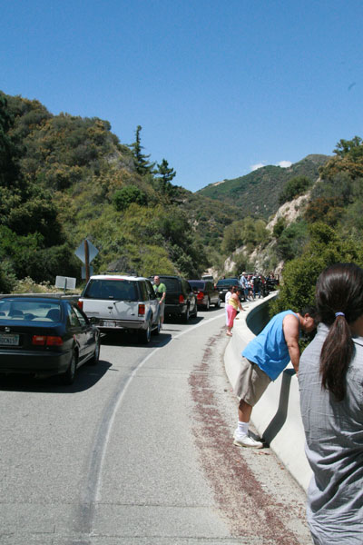
And then we hit a road block---literally. At mile 61, the road was completely closed off with large metal gates. Unsure of what to do, we parked and BF ran ahead to see if the trailhead was close by. A few minutes later, he ran back and told us we were just around the corner from the Pacific Crest Trail. We consulted the map and saw that taking the PCT would just add 2 miles to the trip, and rather than turn around and find a new trail, we went ahead to find the PCT.

Here's where things really started to go awry. Because the Pacific Crest Trail is 2650 miles long, we weren't sure exactly what portion of this trail we were jumping on. Sure, the sign said "PCT", but it turns out we were actually four miles from the real trailhead.

The trail we found simply took us about a mile over a small hill and then deposited us back on the closed highway. Back on the highway, we decided to just keep walking along the road until we found our trail. I think we all knew it was still three miles away, but we were in denial. Personally, I thought we'd just walk along the highway until we got bored and then walk back. Who needs Mt. Islip?

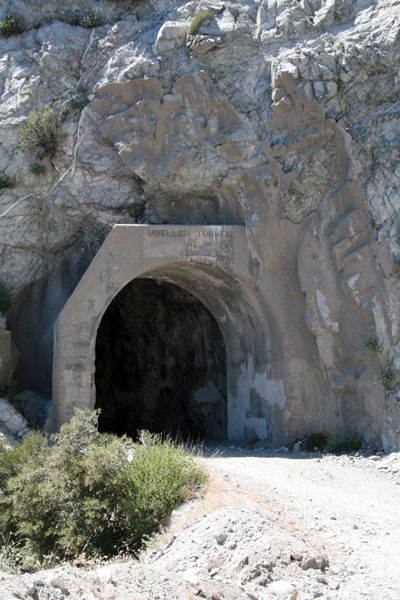
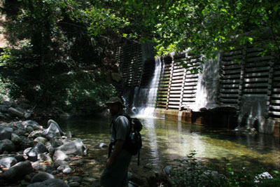
It was definitely eerie to be on the highway all alone. EVG and BF agreed that it was like The Stand. The creepiness factor increased when we arrived at two long, dark tunnels. BF walked ahead of EVG and I, and I got this shot of him:

tunnel

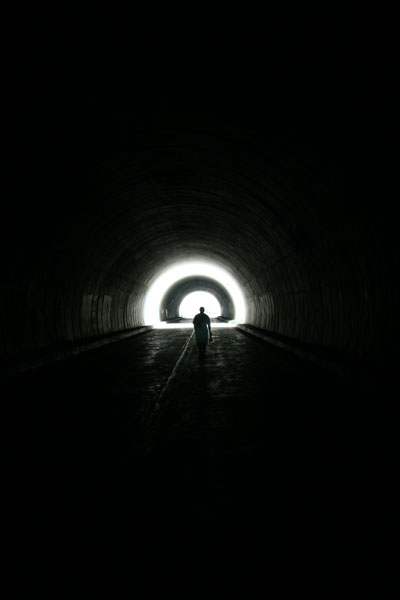
"Go towards the light, Carol Ann!"

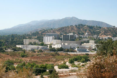
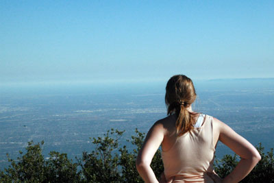
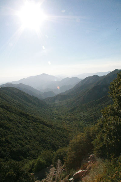
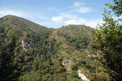
When we made it through the empty tunnels, we were treated to a lovely view:

valley

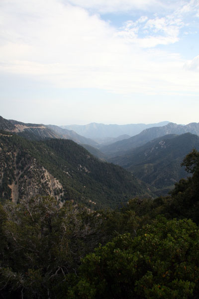
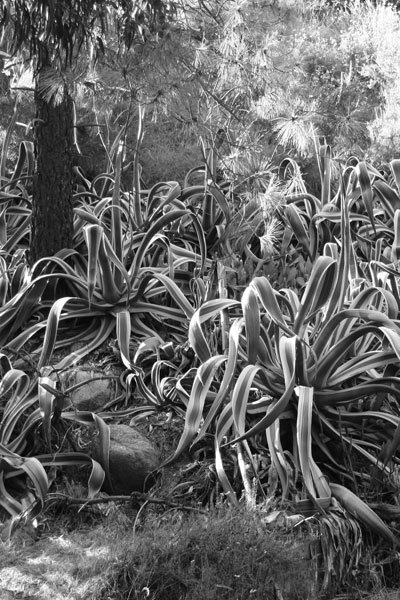
It was the first time hiking around L.A. where I truly felt isolated. We were so high up the mountain that the landscape and foliage was completely different. Luckily, so was the weather. Though mother nature was breaking records in the L.A. basin with 100°+ weather, up in the mountains it was cool and breezy. It was also quickly turning overcast.

Before we left for the hike, as I was filling up my gas tank in Echo Park, I pointed up at the clouds in the distance. I told EVG and BF that those were developing thunderheads. I also told them we'd get rained on. They didn't believe me.

Fast-forward to approximately 6 p.m. and we were walking steadily into the shadow of thunderclouds. Still skeptical, BF and EVG pressed on to find the trail. Finally, after three miles of steadily-uphill climbing on the abandoned highway, we found the trailhead.

From the trailhead we were supposed to hike about 2.5 miles to the top of Mt. Islip, 1250 feet above us, and then return from whence we came. I was already trying to veto actually making it to the summit when we heard the first claps of lightning. Unfazed, EVG and BF kept climbing, and I followed.

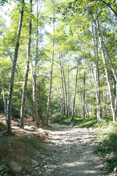
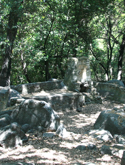
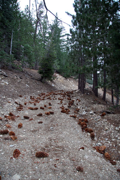
We dubbed the beginning of the trail "the pinecone highway". Here's why:

pinecones

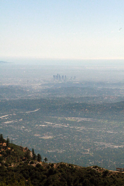
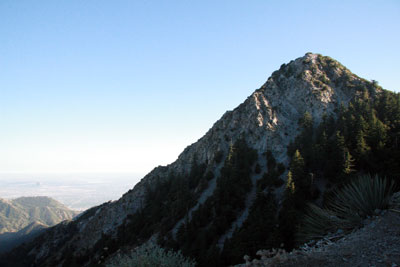
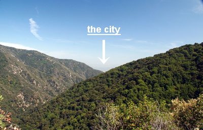
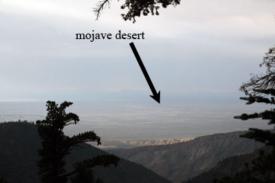
The air was sweet with the smell of pine trees when the rain started to fall. It was just a few drops here and there, so we kept going. At the top of the pinecone highway, where the trail turned towards Little Jimmy Campground, we got a good view of the mojave desert below us:

mojave

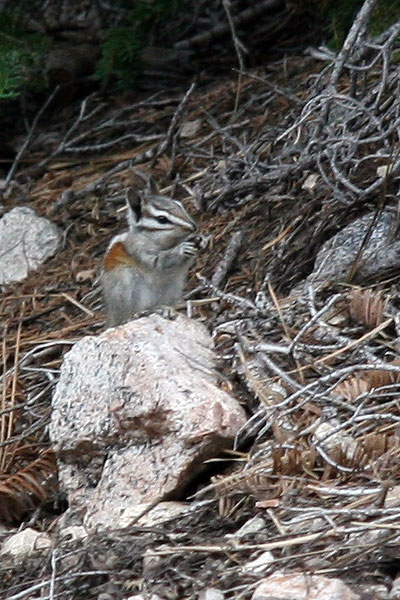
We pressed on. We heard the thunder get louder and louder, and soon we were seeing the flashes of lightning. We counted the seconds between flash and thunder, and we figured the storm was still a mile away. This chipmunk seemed unperturbed by the thunder:

chipmunk

I, on the other hand, was getting paranoid. I love a good thunderstorm, but I prefer to watch them from low ground and under shelter. We were heading to the summit of a mountain. It was also getting late, and the sun would be going down around 8:30. The rain was getting more intense, and I was only wearing a tank top and shorts. EVG and BF weren't any better clothed than me.

When we arrived at Little Jimmy campground (about 1.5 miles from the trailhead), there were about four people already there with their tents set up and a campfire blazing. Just as we rounded the corner to greet the campers, we saw a bright flash of lightning followed immediately by a deafening thunderclap. Even the campers looked stunned. That one was close. The rain intensified, and we were soon soaked. It was 7:30. We were on the dark side of the mountain. If we were to try and make the summit, we'd be hiking the whole trail back down in the dark. BF had a headlamp, but EVG and I had no flashlights.

Though BF and EVG were set on the idea of hiking up to the summit, I had to veto it. After explaining myself, EVG and BF both realized that the responsible thing to do was to hike back down. Mt. Islip would have to wait for another day.

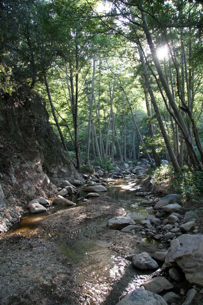
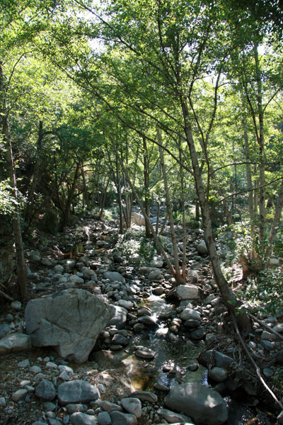
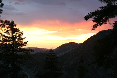
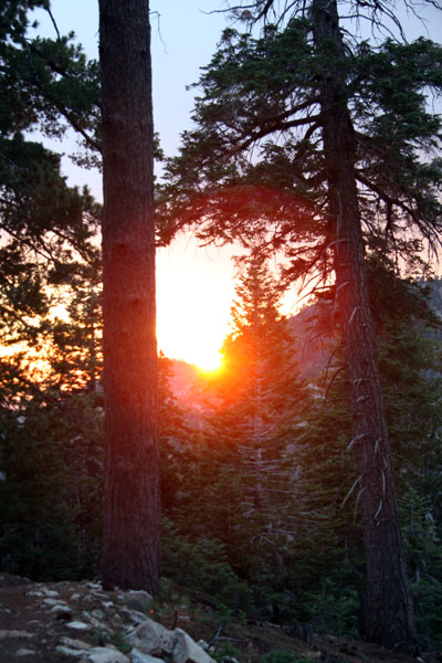
On the way down, the sun started to set. Rather than go back to the trailhead, we took the PCT an extra mile back down to the road. It saved us a little mileage and turned out to be the highlight of the trip. The following shots were both taken as the sun set on the PCT:

sunset1

sunset2

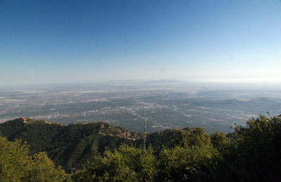
We arrived back on the abandoned highway just as it became too dark to see where we were walking. BF whipped out his headlamp and we headed back the three miles to our car. From the road, we got a perfect view of a great thunderstorm over the L.A. basin. We could see whole strokes of lightning, from cloud to ground.

Walking back through the abandoned tunnels in the dark was undoubtedly creepy. EVG, being a horror writer, wanted BF to turn off his headlamp so we could walk in the dark. Figuring that not walking into the tunnel walls was more important than giving EVG new writing material, BF kept his light on. Even with the headlamp, I have to admit that I looked behind me a few times, half expecting to see an apparition trailing us.

After we made it through the tunnels alive, the walk back to the car was all anticipation. All in all, our short 5 mile hike turned into an 11-mile trek. All three of us were ecstatic to see the car again. EVG had a cigarette, BF took his heavy backpack off, and I sat down in the driver's seat, relieved to be off my feet. We were done.

And we didn't kill EVG.


Blogged: July 18, 2006

Arroyo Seco

Hiked: July 15, 2006


Saturday was the first day of a major heat wave that swept across the entire country. The national weather service had issued a heat advisory for basically all of Southern California. Temperatures in Pasadena were predicted to get as high as 104°F with "increasing humidity." They advised people not to leave neither humans nor pets in cars for any period of time, even with the windows cracked. Remember all those people who forgot their infants in cars a few years back? The national weather service remembers, and they wanted to send out a warning. Stay indoors, they urged. Keep cool. Avoid sun exposure.

What does the national weather service know, anyway? BF and I were determined to go on a hike, heat wave or no heat wave. But where to go?

Rewind to Friday, when BF and I jetted over to the REI in Arcadia to buy new hiking boots. After my Teva debacle on Mt Lowe, I realized my dire need for new boots. BF also was hurting, literally, for new footwear. Just as we returned from our Mt Lowe hike he noticed that both soles on his old boots had separated from the toe. Sure, they had good air flow, but they certainly weren't trail-worthy.

At REI, a very nice fellow bearing the nametag of "Steve N." helped pair us up with the right hiking boots. Initially I was looking at low-rise cross-training shoes, but Steve N. steered me in the right direction. I needed ankle support, he said, or else my feet would slip too much in the shoe. If my feet slipped too much, I would lose my toenails. Seeing as I wear flip-flops almost 100% of the time, I decided having toenails was something I valued. I got the high-ankle boots. Incidentally, BF and I got the exact same boots. We didn't plan it that way, I swear. We're not trying to be the cute hiking couple that has matching gear.

Anyway, Steve N. asked about our hiking plans for Saturday, and we told him we were still undecided. He immediately recommended the Arroyo Seco trail, just north of Pasadena. He said it was shaded and by a river. A cool hike was promised---double entendre intended.

After REI, we stopped at Trader Joes to pick up some Clif bars. I mention this because I have now discovered my favorite on-trail snack: the Clif Nectar bar. A mere $0.99 at Trader Joes, this bar is tastiness in stick form. I'm not a health-food nut, nor do I particularly care if my produce is organic or pesticide-ridden. I probably should care, but I can't seem to muster up the energy to take on a new cause. What I do care about is taste. I tried the LARABAR once and I nearly spit it out. It may have been organic and raw and whatnot, but it just didn't taste good. The Clif Nectar bar, on the other hand, is delicious. I highly recommend picking one up before your next hike.

Now we're back to Saturday. I had a flute choir rehearsal to attend in the morning, so I wasn't free until about noon. When I got home, BF and I fired up the grill and made some chicken sandwiches. By the time we had cooked, eaten, and digested properly, it was 3 p.m. I don't know how that happens. Somehow we get into a major time-warp before hikes. Regardless, we managed to get ourselves up off the couch and prepared for Arroyo Seco. I think our motivation had a lot to do with wanting to break in our new hiking boots.

Arroyo Seco is a very popular trail that originates in Altadena. Because of its proximity to the city and the well-kept trails, you see a lot of picnicking families, joggers, and bikers. Luckily, most of these people tend to stick to the paved section of the trail. After about one or two miles, the likelihood of running into another human dwindles significantly.

We arrived at the trailhead at about 4 p.m. The parking lot overlooks CalTech's Jet Propulsion Laboratories. I sure hope I'm not compromising national security by posting this picture:

JPL

As we walked towards the trailhead, which happens to be the beginning of the Gabrielino trail, we got views of the JPL from many angles. I thought about all the crazy physics going on in those buildings. BF reminded me that physicists probably took Saturday off.

It was hot. There was no question about it. We had three liters of frozen water (a.k.a. "ice") in BF's backpack, as well as 3 more liters of cold liquid-form H2O. At first we thought this was a bit of overkill. Then we started walking the trail. The first mile or so of the trail is all paved road, with little shade. I felt like my face might catch on fire. I felt my pulse in my cheeks like a bass drum - BOOM BOOM BOOM. I started to wonder where this river and shade was that Steve N. had promised. BF and I killed the first 1.5L of water in the first mile. Then we started to wonder if we had enough water for the trip.

Luckily the trail meandered down to the stream side after about a mile and we were shaded by the beautiful trees. We dipped some scrap cotton fabric (makeshift bandanas, we figured) in the stream and plopped them on our heads. BF and I started to cool down and notice the beautiful scenery:

drycreek

The trail continues along the stream, which was thankfully not true to its Spanish name (arroyo seco translates to "dry stream") and provided us with many scrap-cloth dips along the way. The trail crosses the stream a few times along the way, but all the crossings were very easy to navigate. Here's one:

riverbed

The stream was less-than-mighty at times:

trees

But it was always pretty. Under the trees and by the water, the temperature dropped considerably. It was even pleasant at times. As the sun started to go down, I started to wish I had bug repellant on. I swatted a good number of unidentified buzzing insects away from my face and arms and somehow managed to escape without any mosquito bites. (Writer's note: mosquitoes love me. I'm their meal of choice. To go anywhere without falling victim to these blood-suckers is a major accomplishment for me.)

On the trail, there are a few different landmarks conveniently spaced along the way. There's the Gould Mesa Campground at about 2.5 miles, the Nino picnic area at the 3-mile mark, and then the Paul Little picnic area at mile 4. According to our hiking book, we should have walked an extra mile past the Paul Little picnic area to the Oakwilde campground. The book also mentioned that this section of the trail was a steep climb up the side of a cliff. BF and I decided 8 miles was plenty and turned around.

We did see a deer on this trip, but it didn't stick around like the one on Hoegee's Loop, so we have no pictures as proof. We did see a lot of lizards, as usual, and got a shot of this one as it was doing push ups:

lizard

We also had a rabbit run across the trail. All in all, it was a good day for wildlife. Still no cougars, though. (Is that a good or a bad thing?)

Apparently the Arroyo Seco trail used to be occupied by lots of resort cabins in the 1930s. Now you can only spot the stone foundations and the occasional wall. The real impact of these cabins is all the non-native flora that still thrives along the trail. We were told to look for agave plants. We think these are agave---they look a lot like century plants, but they're MUCH bigger:

agave2

maybeagave

We also saw quite a few eucalyptus trees. We didn't bother taking a picture of them, but we did take some shots of this weird and colorful plant:

colorcrazy

I have no idea what it is (I'm sure someone more educated in botany can identify it for me), but it was crazy colorful and had spines. BF was getting artistic with his digital SLR here:

crazycactus

By the time we got back to the paved portion of the trail, the sun had disappeared behind the Jet Propulsion Laboratory. In the end, we only drank three liters of water plus a sample of the partially-frozen bottle. We survived sans heat stroke. It was a successful trip.

Summary Judgment


Nice trail, though the beginning is a little boring and hot. May be too crowded for comfort on holidays. Easy, with very little elevation gain and only basic trail-navigating skills needed.


Blogged: July 10, 2006

Mount Lowe

Hiked: July 8, 2006


Once again, BF and I got a late start hiking. We set our alarms for 9 a.m., hoping to wake up bright-eyed and bushy-tailed, ready to set off towards... well, the first problem was that we didn't know where we were hiking. The night before, we both sat around reading our various hiking books while watching TV (me) and playing internet poker (BF). Needless to say, we didn't come to a conclusion on where to hike.

After pressing snooze for about an hour, I got a call from my good friends N&N. Apparently N&N were at the Brite Spot, a fabulous diner around the corner from my apartment, and they were wondering if BF and I wanted to join them for breakfast. We did. BF, N&N, and I had a leisurely breakfast---so much so that the waitress had to kick us out because she "needed the table." Then we all walked down to the park to check out the Lotus Festival, an annual celebration of Asian and Pacific Islander cultures.

Eventually, BF and I realized that if we were going to hike, we needed to stop lollygagging and get our butts on the mountain. N&N needed to get back to their lovely dog, Katie, anyway, so we parted ways. Before N&N left, though, we promised to hike to Dawn Mine together soon.

Back at the apartment, BF and I nearly didn't make it out to hike. I flopped down on the couch, and he parked himself in front of the computer. Once again, we were both lazily thumbing through hiking books without making anything resembling a decision of where to hike. Somehow we peeled ourselves away from lethargy and got out the door. I made the final decision to go to Mount Lowe. The book said it was a 3.2 mile hike, with approximately 500 feet elevation gain/loss. Seeing as it was almost 2 p.m., and would probably be 3 before we got to the trailhead, I figured an easy hike was the way to go.

Because this seemed like an easy hike, I decided to wear my Tevas. Flash forward to 6:30 p.m. and my feet looked like this:

dirtyfeet

But I'm getting ahead of myself.

To get to Mount Lowe, you take highway 2, also known as the Angeles Crest Highway, about 14 miles from La Cañada, then you turn and go 2.4 miles up Mount Wilson Road. We ran into our first snag about 3 miles up the Angeles Crest Highway. We had been coasting along, enjoying the fabulous views and bright sunshine, when we saw a ranger holding up a stop sign on the side of the road. She gestured ahead of us, and we saw that there was a growing line of stopped cars in our path. We dutifully stopped and speculated on the cause of the backup. I thought maybe a rock slide had blocked off a lane of traffic. I was wrong. After four emergency vehicles screamed past, sirens blaring, and a ranger search & rescue helicopter started circling ahead, we figured out there had been an accident. The helicopter landed just past the curve in the road. People started turning off their engines and getting out to see what all the hubbub was about:

backup

Inquiring minds walked ahead to see the wreckage, and reported back that there had been a motorcycle crash. About 20 minutes later, the helicopter took off again, and a tow truck carried the wreckage of the motorcycle down the mountain, and the emergency vehicles puttered off. We were allowed to drive again.

I want to take a second and say just how beautiful the Angeles Crest Highway really is. Though I was driving and couldn't gaze at the mountains for extended periods of time, I thoroughly enjoyed the drive to Mount Lowe.

We arrived at the trailhead and got cracking on our hike. The first part of the hike follows an unused fire access road. The road hugs the side of the mountain, and then goes through a large tunnel:

tunnel

The inside of the tunnel was covered in concrete, presumably to stop the rock from breaking off and hitting us in the head. BF and I both noted how "fake" the contouring inside the tunnel looked. It was very Disney-esque. I've noticed this in nature elsewhere, too. Sometimes forests look scarily like the fake trees you see in theme parks. Or real granite rocks look like they're made out of chicken wire and sprayed-on plaster. What's particularly disturbing about this is that I find myself comparing the real world to manufactured reality, but I'm using the fake example as the standard. I don't go to theme parks and say, "Wow! Those look like real rocks!" I got into nature and say, "Wow! Those look just like the ones at Six Flags!"

And this is why I'm trying to hike more. Real world = good. Fake world = entertaining, but still fake.

Back to the hike. About a half-mile down the fire road, you take a left and go up a dirt hiking trail. I was pleased because this trail was mostly shaded. BF and I spotted some big fat lizards and consistently great views. I have to say that the views are spectacular right from the beginning. Hell, where we parked there was a great view of Mt. Baldy in the distance. You can't go wrong with this hike.

Another mile or so and we were almost done with the first leg of our hike. We had barely broken a sweat. I looked at our book, and there was a short mention of "adding 2 miles" to the hike by taking the East and West Mount Lowe trail around the mountain. That path would loop us around to the peak, then deposit us back where we started. There was a little diagram of the loop, but no topographical information. We decided to do it.

We started to loop around the South side of the mountain. The views of the L.A. basin were stunning. I then decided that I would have to come back up to Mt. Lowe the next time the smog lifted (or got blown/washed away). Even though the day was a bit hazy with pollution, we could still see all of Los Angeles, all the way to the ocean:

downtown

As the East Mt Lowe Trail continued on, we started to lose elevation quite fast. I started to become concerned that my Teva-clad feet weren't up for this trip. There were a few really slippery and rocky spots where closed-toed shoes would have been welcome. I even slipped and fell once or twice. (I have a gnarly bruise on my leg and a sore hand, but no serious dings.) After about a mile of steady descent, BF and I arrived at the West Mt Lowe Trail.

Guess what? What goes down must come up. The next mile or so was all uphill, and fairly steep in sections. I had to take it slowly. BF was very patient with my huffing and puffing. I was turning red, I think. I even thought, "Now this is cardio!"

Not a moment too soon we arrived at the rocky peak of Mount Lowe. There was even a rickety bench for me to sit on. After a good long drink of water, and finishing some fruit leather (I think I had low blood sugar), I stood up to look around. Here's me looking out over L.A.:

me

Here's the view facing North from Mount Lowe. (One of these peaks is called "Mount Disappointment". I like that.):

disappointment

Another view of the L.A. basin from the top:

labasin

After soaking in the views for a while, BF and I headed back down the trail. This leg of the trip was refreshingly easy, all gradually downhill and no tricky rocky spots. About three-quarters of a mile from the trailhead, there a great sweeping view of a valley. (I was trying to be artistic, getting the sun flare in the picture.)

valley

Once we regressed through the Disney-tunnel, we got a clear view of Mount Lowe's summit:

peak

It's always nice to look back and say, "Wow! We were just at the top of that mountain!" The best part of the Mount Lowe hike is that you can do this on a fairly easy trail and in an afternoon.

Summary Judgment


Awesome trail. I don't have anything negative to say about it. Beautiful views, great trails, customizable for length and difficulty. Even the drive to and from the trail is nice. I'll be returning on the next clear day.


Blogged: July 5, 2006

Hoegee's Loop

Hiked: July 2, 2006


BF and I got a late start on Sunday morning. We aren't accustomed to waking up in the A.M. on the weekend, so dragging ourselves out of bed by 8:30 for the hike was a tad unsettling. We cooked eggs and leisurely sat around the apartment, trying to figure out when and where we were going.

Our friends WC and NO had considered joining us on this trek, but NO hadn't called, which meant she wasn't coming, and WC had trepidations. BF and I hadn't decided on a specific hike by 9:30 (so many to choose from!), and he wasn't able to dedicate his whole day to schlepping around the Angeles National Forest, so WC passed on the hike as well.

Down to just BF and I, we finally had to decide on a hike. Initially, BF wanted to go to Mt. Baden-Powell. I was worried that it was too far away (possibly 70 miles, depending on which you go), and also that it would be too strenuous for a "first" hike.

I've done a lot of hiking in my life, but I have to say that I've been relatively sedentary for the past few years. I'm a writer and do web coding and design to make money, so most of my day is spent in front of a computer. BF and I acquired a free treadmill from craigslist a few months ago, and I had been making efforts to use it regularly until about two months ago when it spontaneously stopped functioning. Mr. Treadmill still ran, but he slipped and screamed whenever you started to walk faster than four miles per hour. BF and I have been trying to fix him---we've made some major breakthroughs in the past week---but for now he's gathering dust (and taking up space) in our living room.

I've used the broken treadmill as an excuse not to exercise for far too long. The problem is that I hate the concept of exercising. I have major hang-ups about exercising in public---I'm not sure why, but I assume everyone's criticizing my technique and judging me---and it's not easy to exercise in your living room sans Mr. Treadmill. Though I hate exercising, I could hike forever and I never think of it as "cardio."

So seeing as I am slightly out of shape, we decided to hike "Hoegee's Loop" as describe in Top Trails Los Angeles. The book promised shade, a "2 out of 5" difficulty level, and approximately 5.3 miles of trail.

From our abode in Echo Park in East L.A., it only took 20 minutes to drive to Chantry Flat, the starting (and ending) point of the hike. After pruning the contents of our backpack to three liters of water and a small collection of varied nutritional bars, we headed on the trail. I carried the camera case, and BF had the heavy backpack.

The loop was planned as follows:

  1. Leave Chantry Flat via the "First Water Trail"

  2. Arrive at Roberts' Camp

  3. Take the "Lower Winter Creek Trail" to Hoegee's Camp

  4. Leave Hoegee's Camp via the "Upper Winter Creek Trail"

  5. Arrive back at Chantry Flat


The initial descent to Roberts' Camp is a gently twisting, quite steep asphalt road. At 12:30 in the afternoon, the heat from the sun radiated off the road insidiously. BF and I noted how unpleasant it would be to return on the steep road. There were a fair amount of people making their way up the road, and you could see the anguish in their faces as the slowly passed by. We descended into the Santa Anita canyon rapidly, the hills towering over us as we walked. After about a half mile (these are all completely uneducated estimates), we found ourselves in a shady landing. A sign pointed towards Hoegee's Camp in one direction and then towards the First Water Trail in the other. Thinking we were at the terminus of the loop. BF and I headed toward the First Water Trail, as it was the first trail listed in our guide.

We walked downstream for about a mile, enjoying the shade of the trees and the scattered 1920s-era cabins that still sit streamside. This is a view from the First Water Trail:

stream

According to the guide, we had to take a left at some point and go upstream. We couldn't figure out where this would happen. We had been heading downstream for a mile, and there was no sign of the trail turning the other way. We ventured a bit further, along a narrow, cliff-hugging path until we arrived at a small swimming hole. There were a few people jumping off the rocks into the pool below:

jump

Of course, those people jumping into the water were also drinking beer. I marveled at their casual attitude towards impending quadriplegia, and BF observed that carrying an ice cooler along that crumbling trail required a noted lack of common sense. Either that or a raging case of alcoholism. Either way, BF and I decided we should leave before we were witnesses to a drowning.

Consulting our map, we realized our problem. Rather than take the long paved road to its terminus, we were supposed to cut off onto an "obscure trail" about .2 miles from the start. Amazed that we somehow missed the "obscure trail," we then saw that we just picked up the First Water Trail at Roberts' Camp. We had simply been backtracking. BF and I dutifully turned around and made our way back to Roberts' Camp, which added about a mile to our trip. The trip back to Roberts' Camp was completely uphill and upstream, but we were still shaded and we only passed one or two hikers, so our hiking experience was still a pleasant one.

Back at Roberts' Camp, we followed the trail marker towards Hoegee's Camp. According to our book, Hoegee's Camp was a gold mining operation from the 1850s-1950s. We were told there would be interesting detritus left over from the mining operation. The Lower Winter Creek Trail took us toward our destination, 1.5 miles ahead. The trail was well-worn, easily followed, and mostly packed dirt. There were a few easy river crossings. The trail wound its way uphill around multiple concrete dams:

dam

The trail was a bit relentlessly uphill. Though the book only claims 1300 feet are gained and lost in this hike, they are all done fairly quickly. The descent down to Roberts' Camp is rapid, done in probably less than a mile, and then at least 2 miles are straight uphill. The grade is forgiving, but it did make sedentary me sweat just a tad.

When we arrived at Hoegee's Camp, we saw the aforementioned "detritus" from the mining operation. There were a few US Forest Service issued camping stoves lying around. Most notably, there were the remains of some sort of building, with a stove or fireplace still intact:

stove

Being the spoiled brat I am, this didn't really pass muster as real "history" for my sensibilities. I've been to Europe---now those old buildings are historical. But I suppose history in Southern California only dates back to whenever someone devised a way to get water down into the desert they now call Los Angeles, so the remains of Hoegee's Camp would qualify.

BF ran off to the outhouse for a moment and I decided to poke around the campsite a little more. I walked over to get a better picture of the stone building when I saw:

deer

Lil' Miss Deer was looking for some good greens to eat when I happened upon her. I was convinced she'd bolt the minute I took a picture, but by the time BF returned from the loo she was still standing in front of us. BF and I proceeded to take pictures of her for the next 15 minutes.

deer2

Eventually, we decided to leave her alone and get trekking on our hike. We were about to pick up the Upper Winter Creek Trail, and we were looking forward to some walking downhill.

Unfortunately, we had some delayed gratification with the Upper Winter Creek Trail. It continued to snake uphill for another half mile or so (much to my chagrin), until it leveled off above the canyon. Though the trees were thick, we got a few good views of the canyon we had just emerged from:

clouds

Eventually, after a close call with a bee hive, we could even see the city in the distance.

city

The path slowly meandered downhill, with nice but not extraordinary views, for quite some time. Finally, we could see the parking lot:

parkinglot

BF liked how these trees looked (they were quite red in "real life"):

redtrees

The best part of choosing to do the loop was that we never had to ascent that horrendous asphalt road. The Upper Winter Creek Trail dropped us off on a fire service road, which then plopped us on the opposite end of the parking lot from where we departed. We found our car and drove home, by way of CostCo, and thus ended our first hike in L.A.

Summary Judgment


Pros:

  • Nicely paced walk, easily finished in an afternoon

  • Close to the city/Short drive

  • Shaded almost the entire way---great for a hot day

  • Trail is well marked, easily followed

  • Cool stream runs along the first few miles, great for head-dipping


Cons:

  • Views not particularly spectacular

  • Historical importance overrated


Conclusion:

  • Well worth the trip.


If you'd like more detailed information about the hike, including topo maps and specific mileage information, check out Dan's Hiking Pages and Top Trails Los Angeles, the book we used for this hike.